ZCZC MIATWOEP ALL
TTAA00 KNHC DDHHMM
Tropical Weather Outlook
NWS National Hurricane Center Miami FL
1100 AM PDT Mon Jul 26 2021
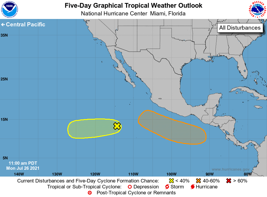
For the eastern North Pacific...east of 140 degrees west longitude:
1. A small but well-defined area of low pressure located about 700
miles south-southwest of the southern tip of the Baja California
peninsula is producing limited shower and thunderstorm activity.
Some gradual development of this system is possible over the next
several days as it moves westward at around 10 mph.
* Formation chance through 48 hours...low...10 percent.
* Formation chance through 5 days...low...20 percent.
2. An area of low pressure is forecast to develop in a few days several
hundred miles south of the Gulf of Tehuantepec. Environmental
conditions appear conducive for some gradual development thereafter,
and a tropical depression could form late this week or over the
weekend while the system moves west-northwestward at around 15 mph,
remaining several hundred miles offshore of the coast of southern
Mexico.
* Formation chance through 48 hours...low...near 0 percent.
* Formation chance through 5 days...medium...40 percent.
Forecaster Reinhart/Pasch