ZCZC MIATWOEP ALL
TTAA00 KNHC DDHHMM
Tropical Weather Outlook
NWS National Hurricane Center Miami FL
500 AM PDT Mon Jul 26 2021
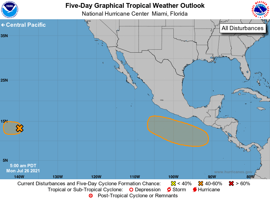
For the eastern North Pacific...east of 140 degrees west longitude:
1. An elongated area of low pressure located over 1000 miles
east-southeast of the Hawaiian Islands is producing disorganized
showers and thunderstorms. Environmental conditions are gradually
becoming less conducive for development of a tropical depression
while the system moves westward at about 15 mph. By Tuesday,
conditions are expected to become unfavorable for any further
development. The disturbance is moving into the Central Pacific
basin, and future information on this system can be found in
products issued by the Central Pacific Hurricane Center.
* Formation chance through 48 hours...medium...40 percent.
* Formation chance through 5 days...medium...40 percent.
2. An area of low pressure is forecast to develop in a few days several
hundred miles south of the Gulf of Tehuantepec. Environmental
conditions appear conducive for some gradual development thereafter,
and a tropical depression could form late this week while the system
moves west-northwestward at 10 to 15 mph, remaining several hundred
miles offshore of the coast of southern Mexico.
* Formation chance through 48 hours...low...near 0 percent.
* Formation chance through 5 days...medium...40 percent.
Forecaster Reinhart/Pasch