ZCZC MIATWOEP ALL
TTAA00 KNHC DDHHMM
Tropical Weather Outlook
NWS National Hurricane Center Miami FL
1100 PM PDT Sun Jul 25 2021
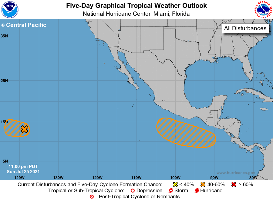
For the eastern North Pacific...east of 140 degrees west longitude:
1. A well-defined low pressure system located about 1100 miles
east-southeast of the Hawaiian Islands continues to move westward at
about 15 mph. Shower and thunderstorm activity remains disorganized,
and environmental conditions are gradually becoming less conducive
for additional development to occur. However, any increase in the
organization of the shower activity would result in the formation of
a tropical depression on Monday. The low is forecast to move into
the Central Pacific basin by late Monday morning, and by Tuesday
conditions are expected to become unfavorable for further
development.
* Formation chance through 48 hours...medium...60 percent.
* Formation chance through 5 days...medium...60 percent.
2. An area of low pressure is forecast to develop by midweek a few
hundred miles south or southeast of the Gulf of Tehuantepec.
Thereafter, some gradual development is possible through late this
week while the system moves generally west-northwestward at 10 to 15
mph, remaining a couple of hundred miles offshore of the coast of
southern Mexico.
* Formation chance through 48 hours...low...near 0 percent.
* Formation chance through 5 days...medium...40 percent.
Forecaster Stewart