NHC Tropical Cyclone Text Product Descriptions
Download the NHC Product Description User's Guide for all tropical cyclone-related products.
- TC Public Advisory (TCP)
- TC Forecast/Advisory (TCM)
- TC Forecast Discussion (TCD)
- TC Wind Speed Probabilities (PWS)
- TC Update (TCU)
- Tropical Weather Outlook (TWO)
- National TC Valid Time Event Code (TCV)
- TC Aviation Advisory (TCA)
- Hurricane Local Statement (HLS)
- Tropical Cyclone Reports (TCR)
- Seasonal Summary Table and Track Map
Tropical Cyclone Public Advisory (TCP) - How to Read
World Meteorological Organization (WMO) and AWIPS (in parenthesis) headers:WTNT31-35 KNHC or KWNH (MIATCPAT1-5) – Atlantic English
WTNT41-45 KNHC or KWNH (MIATASAT1-5) – Atlantic Spanish
WTPZ31-35 KNHC or KWNH (MIATCPEP1-5) – E. Pacific English
WTPZ11-15 KNHC or KWNH (MIATASEP1-5) – E. Pacific Spanish
WTPA31-35 PHFO (HFOTCPCP1-5) – C. Pacific
The Tropical Cyclone Public Advisory is the primary tropical cyclone information product intended for a general audience.
It provides critical tropical cyclone watch, warning, and forecast information for the protection of life and property.
The Public Advisory has five sections:
1) A summary table of several cyclone parameters is placed at the top of the product in a fixed format that is suitable
for parsing by computer software. This section contains the cyclone position in latitude and longitude coordinates, its
distance from a well-known reference point, the maximum sustained winds, the cyclone’s current direction and speed of motion,
and the estimated or measured minimum central pressure.
2) A summary of all current coastal watches and warnings for the cyclone with recent changes to the watches and warnings highlighted at the top.
3) A discussion of the cyclone’s current characteristics, including location, motion, intensity, and pressure and a general description of the
predicted track and intensity of the cyclone over the next 72 hours. When conditions warrant, a discussion of the cyclone’s forecast track and
intensity through 5 days will be included. Any pertinent weather observations will also be included in this section.
4) A section that includes information on hazards to land, generally within the time period when watches and/or warnings are in effect. This
section includes information on hazards such as storm surge, wind, rainfall, tornadoes, and rip currents associated with the cyclone. When
numerous locations are affected by storm surge or rainfall, weblinks will be provided to direct users to pertinent graphical hazard information.
5) A section that states the time of the next advisory issuance.
Public advisories are issued for all Atlantic, eastern, and central Pacific tropical or subtropical cyclones. Public advisories on potential tropical cyclones may be issued for disturbances that are not yet a tropical cyclone, but which pose the threat of bringing tropical storm or hurricane conditions to land areas within 72 hours. Post-tropical cyclone public advisories are issued when a cyclone continues to pose a significant threat to life and property after it is no longer tropical, and if the transfer of responsibility to another office would result in an unacceptable discontinuity of service.
Public advisories for Atlantic tropical cyclones are normally issued every six hours at 5:00 AM EDT, 11:00 AM EDT, 5:00 PM EDT, and 11:00 PM EDT (or 4:00 AM EST, 10:00 AM EST, 4:00 PM EST, and 10:00 PM EST). Depending on the cyclone’s location and forecast track, advisories may also be issued in Central Time (CDT or CST), Atlantic Standard Time (AST), Cabo Verde Standard Time (CVT), or Greenwich Mean Time (GMT).
Public advisories for Eastern Pacific tropical cyclones are normally issued every six hours at 2:00 AM PDT, 8:00 AM PDT, 2:00 PM PDT, and 8:00 PM PDT (or 1:00 AM PST, 7:00 AM PST, 1:00 PM PST, and 7:00 PM PST). Depending on the cyclone’s location and forecast track, advisories may also be issued in Central Standard Time (CST), Mountain Standard Time (MST), or Hawaiian Standard Time (HST).
Public advisories for Central Pacific tropical cyclones are normally issued every six hours at 5:00 AM HST, 11:00 AM HST, 5:00 PM HST, and 11:00 PM HST.
Intermediate public advisories are issued every 3 hours when coastal watches or warnings are in effect. United States tropical cyclone watches or warnings can be issued with regular or intermediate public advisories. Additionally, special public advisories may be issued at any time due to significant changes in warnings or in the cyclone.
The numbers 1-5 in the headers are assigned on a rotating basis by cyclone number, i.e., advisories on the first, sixth, or eleventh cyclones of the Atlantic season would be sent under the WMO header WTNT31 KNHC; advisories on the second, seventh, or twelfth cyclones of the Atlantic season would be sent under the WMO header WTNT32 KNHC, and so on.
See Example
Tropical Cyclone Forecast/Advisory (TCM) - How to Read
World Meteorological Organization (WMO) and AWIPS (in parenthesis) headers:WTNT21-25 KNHC or KWNH (MIATCMAT1-5) – Atlantic
WTPZ21-25 KNHC or KWNH (MIATCMEP1-5) – E. Pacific
WTPA21-25 PHFO (HFOTCMCP1-5) – C. Pacific
The Tropical Cyclone Forecast/Advisory contains current and forecast storm information in a fixed format suitable
for parsing by computer software. It contains the cyclone position, intensity, and direction and speed of motion.
It also includes the current maximum radial extent of 4-meter seas, as well as the maximum radial extent of winds of
34, 50, and 64 kt in each of four quadrants around the storm. The Forecast/Advisory contains quantitative forecast
information on the track, intensity, and size of the cyclone valid 12, 24, 36, 48, 60, 72, 96, and 120 h from the
forecast’s nominal initial time. Tropical storm and 50-kt wind radii are forecast out to 120 h and hurricane-force
wind radii are forecast out 72 h.
The Forecast/Advisory also contains the predicted status of the cyclone for each forecast time. This status may include
any of the following: inland, dissipated, post tropical, or change in status from subtropical to tropical (or vice versa).
“Post tropical” describes a cyclone that no longer possesses sufficient tropical characteristics to be considered a tropical
cyclone; however these cyclones can continue to produce heavy rains and high winds. A remnant low is a post-tropical cyclone
that no longer possesses the convective organization required of a tropical cyclone and has maximum sustained winds of less
than 34 knots. An extratropical cyclone is a cyclone of any intensity for which the primary energy source results from the
temperature contrast between warm and cold air masses.
Forecast/Advisories are issued on all Atlantic, eastern Pacific, and central Pacific tropical and subtropical cyclones every six hours at 0300, 0900, 1500, and 2100 UTC (learn about UTC time). Forecast/Advisories on potential tropical cyclones may be issued for disturbances that are not yet a tropical cyclone, but which pose the threat of bringing tropical storm or hurricane conditions to land areas within 72 hours. Post-tropical cyclone Forecast/Advisories are issued when a cyclone continues to pose a significant threat to life and property after it is no longer tropical, and if the transfer of responsibility to another office would result in an unacceptable discontinuity of service. Special Forecast/Advisories may be issued at any time due to significant changes in warnings or in the cyclone.
The numbers 1-5 in the headers are assigned by cyclone number, i.e., advisories on the first, sixth, or eleventh cyclones of the Atlantic season would be sent under the WMO header WTNT21 KNHC; advisories on the second, seventh, or twelfth cyclones of the Atlantic season would be sent under the WMO header WTNT22 KNHC, and so on.
See Example
Tropical Cyclone Discussion (TCD)
World Meteorological Organization (WMO) and AWIPS (in parenthesis) headers:WTNT41-45 KNHC or KWNH (MIATCDAT1-5) – Atlantic English
WTNT51-55 KNHC or KWNH (MIATDSAT1-5) – Atlantic Spanish
WTPZ41-45 KNHC or KWNH (MIATCDEP1-5) – E. Pacific English
WTPZ51-55 KNHC or KWNH (MIATCDEP1-5) – E. Pacific Spanish
WTPA41-45 PHFO (HFOTCDCP1-5) – C. Pacific
The Tropical Cyclone Discussion describes the rationale for the forecaster’s analysis and forecast of a tropical cyclone. It will typically discuss the observations justifying the analyzed intensity of the cyclone, a description of the environmental factors expected to influence the cyclone’s future track and intensity, and a description of the numerical guidance models. It may also describe the forecaster’s degree of confidence in the official forecast, discuss possible alternate scenarios, highlight unusual hazards, and provide a summary of key messages. The product also includes a table of forecast positions and intensities in knots and miles per hour out to 120 h. This table also indicates the forecast status of the cyclone, which may include any of the following: inland, dissipated, post tropical, or change in status from subtropical to tropical (or vice versa). “Post tropical” describes a cyclone that no longer possesses sufficient tropical characteristics to be considered a tropical cyclone; however these cyclones can continue to produce heavy rains and high winds. A remnant low is a post-tropical cyclone that no longer possesses the convective organization required of a tropical cyclone and has maximum sustained winds of less than 34 knots. An extratropical cyclone is a cyclone of any intensity for which the primary energy source results from the temperature contrast between warm and cold air masses.
Tropical Cyclone Discussions are issued on all Atlantic, eastern Pacific, and central Pacific tropical and subtropical cyclones every six hours. Tropical Cyclone Discussions on potential tropical cyclones may be issued for disturbances that are not yet a tropical cyclone, but which pose the threat of bringing tropical storm or hurricane conditions to land areas within 72 hours. Post-tropical cyclone Discussions are issued when a cyclone continues to pose a significant threat to life and property after it is no longer tropical, and if the transfer of responsibility to another office would result in an unacceptable discontinuity of service. Special tropical cyclone discussions may be issued at any time due to significant changes in warnings or in the cyclone.
Tropical Cyclone Discussions for Atlantic tropical cyclones are normally issued every six hours at 5:00 AM EDT, 11:00 AM EDT, 5:00 PM EDT, and 11:00 PM EDT (or 4:00 AM EST, 10:00 AM EST, 4:00 PM EST, and 10:00 PM EST). Depending on the cyclone’s location and forecast track, advisories may also be issued in Central Time (CDT or CST), Atlantic Standard Time (AST), Cabo Verde Standard Time (CVT), or Greenwich Mean Time (GMT).
Tropical Cyclone Discussions for Eastern Pacific tropical cyclones are normally issued every six hours at 2:00 AM PDT, 8:00 AM PDT, 2:00 PM PDT, and 8:00 PM PDT (or 1:00 AM PST, 7:00 AM PST, 1:00 PM PST, and 7:00 PM PST). Depending on the cyclone’s location and forecast track, advisories may also be issued in Central Time (CDT or CST), Mountain Time (MDT or MST), or Hawaiian Standard Time (HST).
Tropical Cyclone Discussions for Central Pacific tropical cyclones are normally issued every six hours at 5:00 AM HST, 11:00 AM HST, 5:00 PM HST, and 11:00 PM HST.
For select tropical cyclones, the Tropical Cyclone Discussion will have a companion Key Messages Graphic that will be updated at the same time.
The numbers 1-5 in the headers are assigned by cyclone number, i.e., discussions on the first, sixth, or eleventh cyclones of the Atlantic season would be sent under the WMO header WTNT41 KNHC; discussions on the second, seventh, or twelfth cyclones of the Atlantic season would be sent under the WMO header WTNT42 KNHC, and so on.
See Example
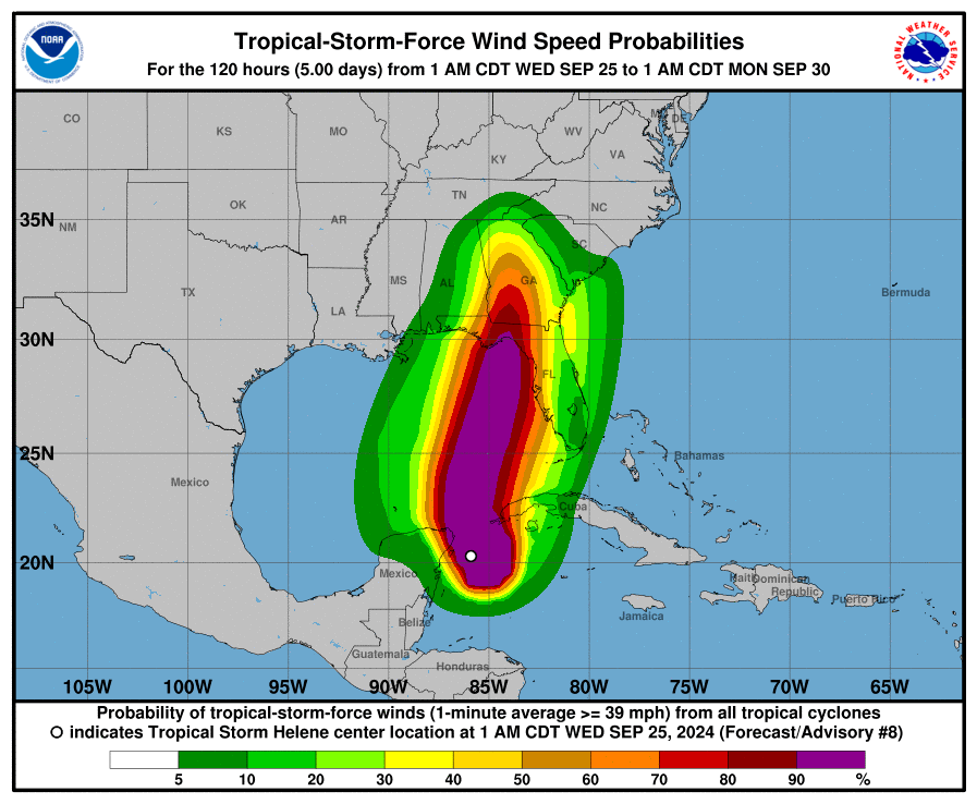
Tropical Cyclone Surface Wind Speed Probabilities (PWS)
World Meteorological Organization (WMO) and AWIPS (in parenthesis) headers:FONT11-15 KNHC (MIAPWSAT1-5) – Atlantic
FOPZ11-15 KNHC (MIAPWSEP1-5) – Eastern Pacific
FOPA11-15 PHFO (HNLPWSCP1-5) – Central Pacific (issued by CPHC)
The Tropical Cyclone Surface Wind Speed Probabilities text product provides probabilities, in percent, of sustained wind speeds equal to or exceeding 34-, 50-, and 64-knot wind speed thresholds. These wind speed probabilities are based on the track, intensity, and wind structure forecasts and uncertainties from the National Hurricane Center and the Central Pacific Hurricane Center and are computed for coastal and inland cities as well as offshore locations (e.g., buoys).
These text products are issued on all Atlantic and eastern Pacific tropical and subtropical cyclones, and potential and post-tropical cyclones when appropriate, every six hours at 0300, 0900, 1500, and 2100 UTC (learn about UTC time). Special tropical cyclone surface wind speed probabilities may be issued at any time due to significant changes in warnings or in the cyclone.
The numbers 1-5 in the header are assigned on a rotating basis by cyclone number, i.e., probabilities on the first, sixth, or eleventh cyclones of the Atlantic season would be sent under the WMO header FONT11 KNHC; probabilities on the second, seventh, or twelfth cyclones of the Atlantic season would be sent under the WMO header FONT12 KNHC, and so on.
Three types of tropical cyclone wind speed probability values are created . Not all of these values will be distributed or placed on the Internet. For each probability value, the event in question is a sustained (one-minute average) surface (10 m) wind speed of at least a particular threshold value (34, 50, or 64 kt) at a specific location.
Cumulative – These values tell you the overall probability the event will occur sometime during the specified cumulative forecast period (0-6 hours, 0-12, 0-18, etc.) at each specific point. These values are provided in both the text and graphical formats. In the text product, the numbers are in parentheses. The graphical products depict only cumulative values. The text product is transmitted to users via normal NWS dissemination methods. The graphic is available on the internet from the National Hurricane Center and the Central Pacific Hurricane Center.
Individual – These values tell you the probability the event will start
sometime during the specified individual forecast period (0-12 hours, 0-24 hours, 0-36 hours, etc.)
at each specific point. These periods are individual, since nothing that
occurs before or after the specified period affects the probability. These values
are provided only in the text NHC product. They are the values outside of the
parentheses (cumulative values are in the parentheses). The term "individual" also
makes a clear distinction from the cumulative period values for users.
Incremental – These values tell you the probability the event will occur sometime during the specified forecast period (0 - 6 hours, 6-12, 12-18, etc.) at each specific point. These values are incremental since they can increase in value by accounting for the possibility the event might start in an earlier period and still be occurring in the specified period. Incremental probabilities are not available in the Tropical Cyclone Surface Wind Speed Probabilities text product, but they are available in the National Digital Forecast Database (NDFD).
Note: View a more detailed description of the wind speed probabilities products.
List of Cities by Basin: Atlantic – Eastern Pacific –
Central Pacific
Tropical Cyclone Update (TCU)
World Meteorological Organization (WMO) and AWIPS (in parenthesis) headers:WTNT61-65 KNHC (MIATCUAT1-5) – Atlantic English
WTNT71-75 KNHC (MIATUSAT1-5) – Atlantic Spanish
WTPZ61-65 KNHC (MIATCUEP1-5) – E. Pacific English
WTPZ71-75 KNHC (MIATUSEP1-5) – E. Pacific Spanish
WTPA61-65 PHFO (HFOTCUCP1-5) – C. Pacific
The TCU is a brief alphanumeric text product containing either block paragraph text, a formatted storm summary section, or both. TCUs are issued to inform users of significant changes in a tropical cyclone in between regularly scheduled public advisories. Such uses include, but are not limited to the following:
- To provide timely information of an unusual nature, such as the time and location of landfall, or to announce an expected change in intensity that results in an upgrade or downgrade of status (e.g., from a tropical storm to a hurricane).
- To provide a continuous flow of information regarding the center location of a tropical cyclone when watches or warnings are in effect and the center can be easily tracked with land-based radar.
- To provide advance notice that significant changes to storm information will be conveyed shortly, either through a subsequent TCU or through a Special Advisory.
- To announce changes to international watches or warnings made by other countries.
- To announce the forthcoming issuance or cancellation of a U.S. watch or warning, but only if the TCU precedes a regular or special advisory that will contain the same watch/warning information, and indicates the advisory will be issued shortly.
The storm summary section is identical in format to the storm summary section found in the TCP. The storm summary section is required whenever the TCU is issued to update storm intensity, location, or motion information. The storm summary section is not required for TCUs issued to provide advance notice that significant changes to storm information will be conveyed shortly, or for those issued to convey changes to watches or warnings.
Tropical Weather Outlook (TWO)
World Meteorological Organization (WMO) and AWIPS (in parenthesis) headers:ABNT20 KNHC (MIATWOAT) – Atlantic English
ACCA62 KNHC (MIATWOSAT) – Atlantic Spanish
ABPZ20 KNHC (MIATWOEP) – E. Pacific English
ABPZ21 KNHC (MIATWOSEP) – E. Pacific Spanish
ABPA20 PHFO (HFOTWOCP) – C. Pacific
The Tropical Weather Outlook discusses significant areas of disturbed weather and their potential for development during the next 7 days, including a categorical forecast of the probability of tropical cyclone formation during the first 48 hours, and during the entire 7-day forecast period. The 48 h and 7-day probabilities of formation for each disturbance are given to the nearest 10% and expressed in terms of one of the following categories: low probability of development (0-30%), medium probability (40-60%), and high probability of development (70-100%).
The Tropical Weather Outlook is issued every six hours from 15 May–30 November for the Atlantic and Eastern North Pacific basins, and from 1 June–30 November for the Central North Pacific Basins at 0000, 0600, 1200, 1800 UTC. Local issuance times are shown in the table below.
| Basin | Local Issuance Times During Daylight Savings Time | Local Issuance Times During Standard Time |
| Atlantic (15 May–30 November) |
2:00 am EDT 8:00 am EDT 2:00 pm EDT 8:00 pm EDT |
1:00 am EST 7:00 am EST 1:00 pm EST 7:00 pm EST |
| Eastern North Pacific (15 May–30 November) |
5:00 am PDT 11:00 am PDT 5:00 pm PDT 11:00 pm PDT |
4:00 am PST 10:00 am PST 4:00 pm PST 10:00 pm PST |
| Central North Pacific (1 June–30 November) |
2:00 am HST 8:00 am HST 2:00 pm HST 8:00 pm HST |
A Special Tropical Weather Outlook is issued when there have been important changes with areas of disturbed weather over tropical or subtropical waters that need to be conveyed before the next scheduled release of the Tropical Weather Outlook. The Special Tropical Weather Outlook can be used to report the findings of reconnaissance aircraft missions, and can also be used for disturbances outside of the normal hurricane season when Tropical Weather Outlooks are not routinely issued. The disturbance being updated in the Special Tropical Weather Outlook will be highlighted at the top of the product, and other systems discussed in previous Tropical Weather outlooks will also be included.
Please note the (Special) Tropical Weather Outlook has a companion Graphical Tropical Weather Outlook that will be updated at the same time.
The most recent Tropical Weather Outlook is found on the NHC home page.
National Tropical Cyclone Valid Time Event Code (TCV)
World Meteorological Organization (WMO) and AWIPS (in parenthesis) headers:WTNT81-85 KNHC (MIATCVAT1-5) – Atlantic
WTPZ81-85 KNHC (MIATCVEP1-5) – E. Pacific
Valid Time Event Code (VTEC) is a standardized code string used to describe the parameters of weather watches, warnings, and advisories (WWA). It is designed to help automate the delivery of NWS WWA information to customers and partners, enabling them to relay it more quickly to the public. The National Tropical Cyclone Watch/Warning text product (TCV) summarizes all new, continued, extended, and canceled tropical cyclone wind and storm surge watches and warnings issued by the National Weather Service for the contiguous U.S., Puerto Rico, and the U.S. Virgin Islands. Separate text products are issued for Atlantic basin storms and Eastern North Pacific storms.
The representation of watches/warnings in the National TCV is provided only in terms of NWS zones; as a result the TCV can only convey an approximate description of the watch/warning areas. The precise lateral extent of tropical cyclone wind watches and warnings along the coastline is specified by breakpoints in the Tropical Cyclone Public Advisory. The precise extent of storm surge watches/warnings is specified in gridded form through the National Digital Forecast Database (NDFD). The National TCV will contain a disclaimer indicating where the precise extent of tropical cyclone watches and warnings can be found.
The National TCV will be issued with all routine, intermediate, and special advisories if US watches or warnings are continued, posted, changed, or canceled.
When active, the most current Tropical Cyclone Valid Time Event Code (VTEC) product can be found on the NHC home page.
TCV products are also issued by each NWS Weather Forecast Office (WFO) that has tropical storm, hurricane, or storm surge watches or warnings in effect. WFO TCVs include plain language information about the threats and impacts expected in each affected NWS zone in addition to the VTEC as seen in this WFO TCV example. The WFO TCV products can be found through links in the NHC storm table when an active tropical cyclone threatens U.S. land.
The WFO TCV for Hawaii (TCVHFO) provides all VTEC for active tropical storm, hurricane, and storm surge watches and warnings for Hawaii, so there is not a separate National TCV product for the Central Pacific basin.
An overview of the VTEC program is available at https://www.weather.gov/vtec/.
Tropical Cyclone ICAO (Aviation) Advisory (TCA)
World Meteorological Organization (WMO) and AWIPS (in parenthesis) headers:FKNT21-25 KNHC (MIATCANT1-5) – Atlantic
FKPZ21-25 KNHC (MIATCAPZ1-5) – E. Pacific
FKPA21-25 PHFO (HFOTCAPA1-5) – C. Pacific
The Aviation Tropical Cyclone Advisory is issued to provide short term tropical cyclone forecast guidance for international aviation safety and routing purposes. The TCA lists the current TC position, motion, and intensity, and includes 3, 6, 9, 15, 21, and 27 hour forecast positions and intensities after the advisory issuance time. Position and intensity forecast information for forecast hours (+06, +12, +18 and +24) is derived from interpolated forecast information – intensity is rounded to the nearest 5 knots.
Issuance of the Aviation Tropical Cyclone Advisory occurs every six hours at the regular advisory issuance time of 0300, 0900, 1500, and 2100 UTC (learn about UTC time). TCAs for special advisories will be issued for the same circumstances that apply for a standard advisory.
Hurricane Local Statement (HLS)
These statements are NOT produced at the National Hurricane Center, but can be found through links in the NHC storm table when an active tropical cyclone threatens U.S. land. Local National Weather Service Weather Forecast Offices (WFOs) produce these local statements to keep the media, local decision makers, and the public current on present and anticipated storm effects in their area. The hurricane local statement provides an overview of storm information and potential impacts on the local area.
Hurricane Local Statements generally present the following:
- A headline
- A description of the counties, parishes, or cities covered by the statement
- Watches and/or warnings in effect and the counties or parishes to which they apply
- A short overview of the most important tropical cyclone information/impacts to the local area
- Recommended precautionary/preparedness actions
- Present tropical storm or hurricane position, movement, and intensity
- Information regarding the potential for impacts from storm surge, tropical wind, tornado, and flooding rain
- The time of the next statement
When there are active tropical storm, hurricane, or storm surge watches/warnings in effect, a graphical representation of the potential threats posed by wind, storm surge, flooding rain, and tornadoes can be found on the Hurricane Threats and Impacts webpage and selecting the Threats and Impacts tab.
See the Hurricane Threats and Impacts Graphics FAQ for more information.
Tropical Cyclone Reports (TCR)
These reports are available on the NHC TCR webpage.The National Hurricane Center’s Tropical Cyclone Reports (TCRs) contain information on all tropical (and subtropical) cyclones that have occurred within the Atlantic and eastern Pacific basins, including synoptic history, meteorological statistics, casualties and damages, and the post-analysis best track (six-hourly positions and intensities). Comprehensive versions of these reports are provided for all tropical cyclones in which coastal watches or warnings were in effect or direct fatalities were reported, and for other select storms with significant public or research interest (e.g., storms investigated via research field campaigns). Otherwise, abbreviated TCRs will be produced that include a short description of the cyclone’s origin, justification of the analyzed maximum winds and minimum pressure, noteworthy statistics, and the post-analysis best track.
Tropical Cyclone Reports (TCRs) are composed after a tropical cyclone has reached its end of life, and all pertinent data has been gathered and analyzed. Once completed, the TCRs are posted to the NHC TCR webpage.
Seasonal Summary Table and Track Map
NHC and CPHC provide a seasonal summary table and a seasonal track map for the Atlantic and eastern and central Pacific basins on each basin’s respective TCR page. These seasonal summary tables and track maps are updated at least monthly, typically at the beginning of each month. The seasonal summary tables and track maps are also updated once all of the TCRs are completed for each basin at the conclusion of the season. The table includes the dates of occurrence for all of the season’s tropical cyclones and basic meteorological statistics, such as the estimated peak intensity.