ZCZC MIATWOEP ALL
TTAA00 KNHC DDHHMM
Tropical Weather Outlook
NWS National Hurricane Center Miami FL
1100 AM PDT Thu Sep 1 2022
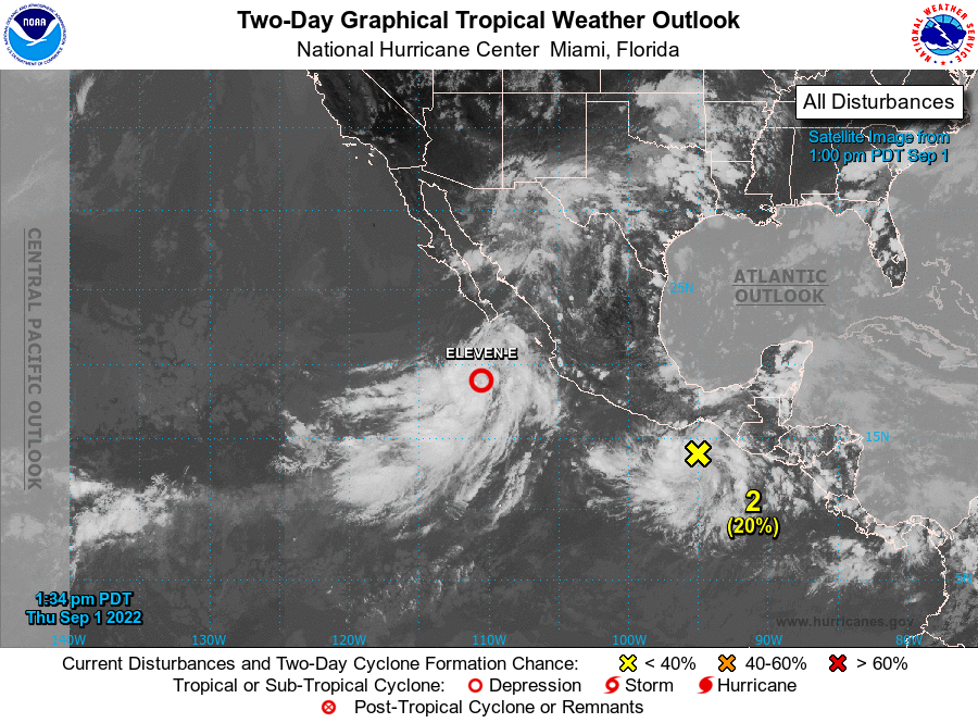
For the eastern North Pacific...east of 140 degrees west longitude:
1. Offshore of West-Central Mexico:
Showers and thunderstorms associated with an area of low pressure
located about 300 miles south of the southern tip of the Baja
California peninsula are gradually becoming better organized.
Environmental conditions appear favorable for development of this
system, and a tropical depression or tropical storm is forecast to
form later today or tonight while moving northwestward at about 10
mph, likely remaining a couple of hundred miles off the western
coast of Baja California Sur. Additional information on this
system, including gale warnings, can be found in High Seas Forecasts
issued by the National Weather Service.
* Formation chance through 48 hours...high...90 percent.
* Formation chance through 5 days...high...90 percent.
2. South of Southern Mexico:
A tropical wave is producing disorganized showers and thunderstorms
near the Gulf of Tehuantepec. Gradual development of this system
is expected, and a tropical depression is likely to form late
this weekend or early next week while it moves westward or
west-northwestward near the coast of southern and southwestern
Mexico. Interests in southern and southwestern Mexico should
monitor the progress of this system.
* Formation chance through 48 hours...low...20 percent.
* Formation chance through 5 days...high...70 percent.
High Seas Forecasts issued by the National Weather Service can be
found under AWIPS header NFDHSFEPI, WMO header FZPN02 KWBC, and on
the web at ocean.weather.gov/shtml/NFDHSFEPI.php
Forecaster Cangialosi