ZCZC MIATWOEP ALL
TTAA00 KNHC DDHHMM
Tropical Weather Outlook
NWS National Hurricane Center Miami FL
500 AM PDT Fri Jul 1 2022
For the eastern North Pacific...east of 140 degrees west longitude:
Active Systems:
The National Hurricane Center is issuing advisories on Atlantic
basin Potential Tropical Cyclone Two, currently located over the
southwestern Caribbean Sea. The system is forecast to cross Central
America and move into the east Pacific basin, as a tropical cyclone,
on Saturday.
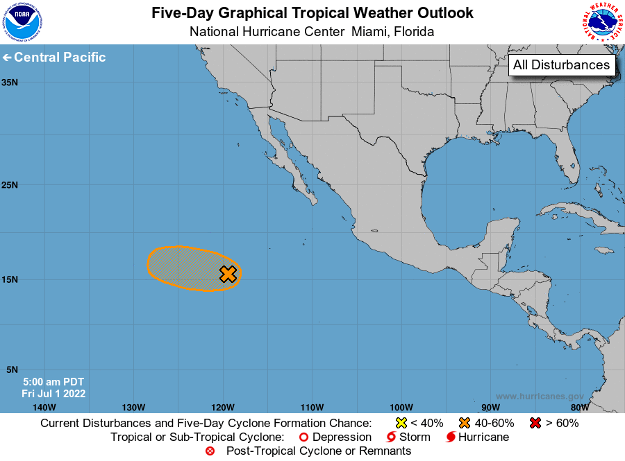
1. Offshore of Southern Mexico:
Satellite data from several hours ago indicate that the area of low
pressure located several hundred miles southwest of the southern
tip of the Baja California peninsula still did not have a
well-defined circulation. The associated showers and thunderstorms
have generally changed little during the past several hours, and
the system only has about another day to become a short-lived
tropical depression before it reaches cooler waters and a dry air
mass while it moves westward at 10 to 15 mph.
* Formation chance through 48 hours...medium...50 percent.
* Formation chance through 5 days...medium...50 percent.
Forecaster Cangialosi/Hogsett