ZCZC MIATWOAT ALL
TTAA00 KNHC DDHHMM
Tropical Weather Outlook
NWS National Hurricane Center Miami FL
800 PM EDT Thu Oct 7 2021
For the North Atlantic...Caribbean Sea and the Gulf of Mexico:
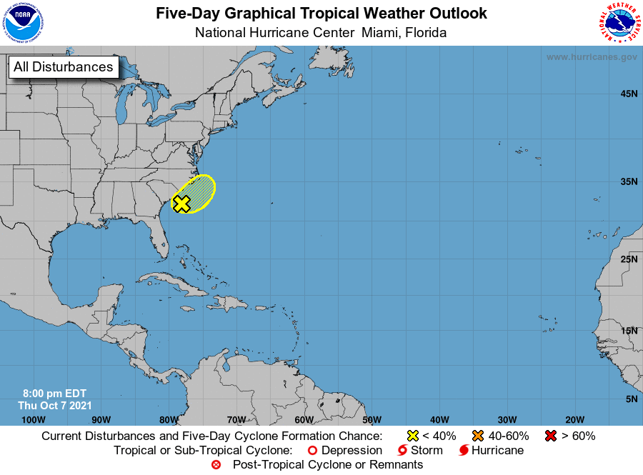
1. A low pressure area located about 100 miles off the coast of South
Carolina is producing disorganized showers and thunderstorms well to
the east of its center of circulation. Strong upper-level winds
should prevent any significant tropical or subtropical development
during the next few days. By late this weekend, the low is expected
to interact with a frontal boundary located to its north, which
should end the opportunity for tropical or subtropical formation.
Regardless of development, the low is forecast to move slowly
east-northeastward at about 5 mph, and it could bring gusty winds
and locally heavy rain to eastern portions of the Carolinas through
the weekend.
* Formation chance through 48 hours...low...20 percent.
* Formation chance through 5 days...low...30 percent.
Forecaster Latto