ZCZC MIATWOAT ALL
TTAA00 KNHC DDHHMM
Tropical Weather Outlook
NWS National Hurricane Center Miami FL
200 PM EDT Thu Oct 7 2021
For the North Atlantic...Caribbean Sea and the Gulf of Mexico:
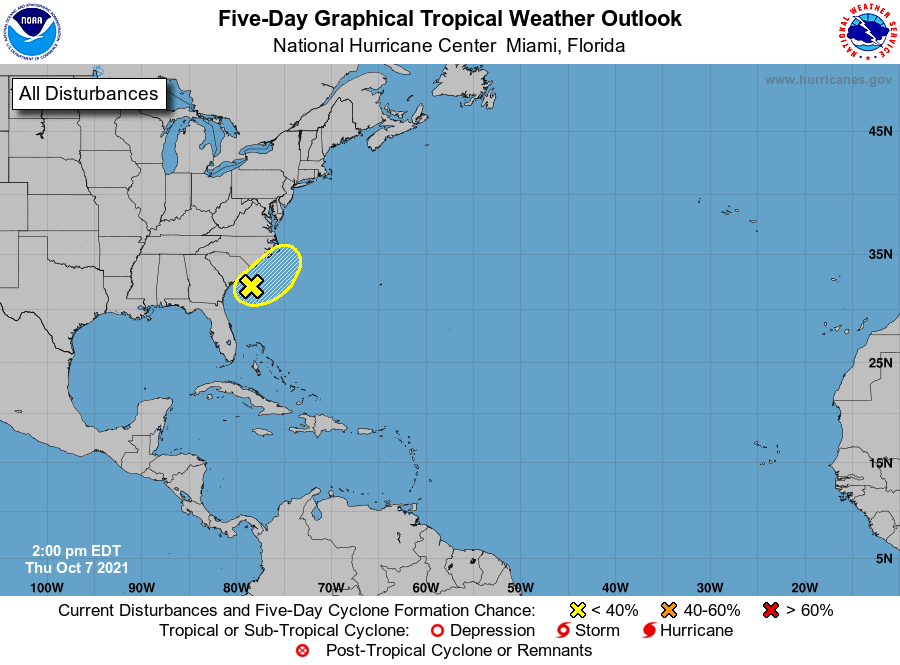
1. A low pressure area located about 100 miles off the coast of South
Carolina continues to produce disorganized showers and
thunderstorms to the east of its center of circulation. Although
upper-level winds are expected to be strong during the next few
days, some tropical or subtropical development will be possible
through the weekend before the low interacts with a frontal boundary
located to its north. The low is forecast to move slowly
east-northeastward at about 5 mph, and it could bring gusty winds
and locally heavy rain to eastern portions of the Carolinas through
the weekend, regardless of development.
* Formation chance through 48 hours...low...20 percent.
* Formation chance through 5 days...low...30 percent.
Forecaster Berg