ZCZC MIATWOEP ALL
TTAA00 KNHC DDHHMM
Tropical Weather Outlook
NWS National Hurricane Center Miami FL
500 PM PDT Sat Oct 12 2019
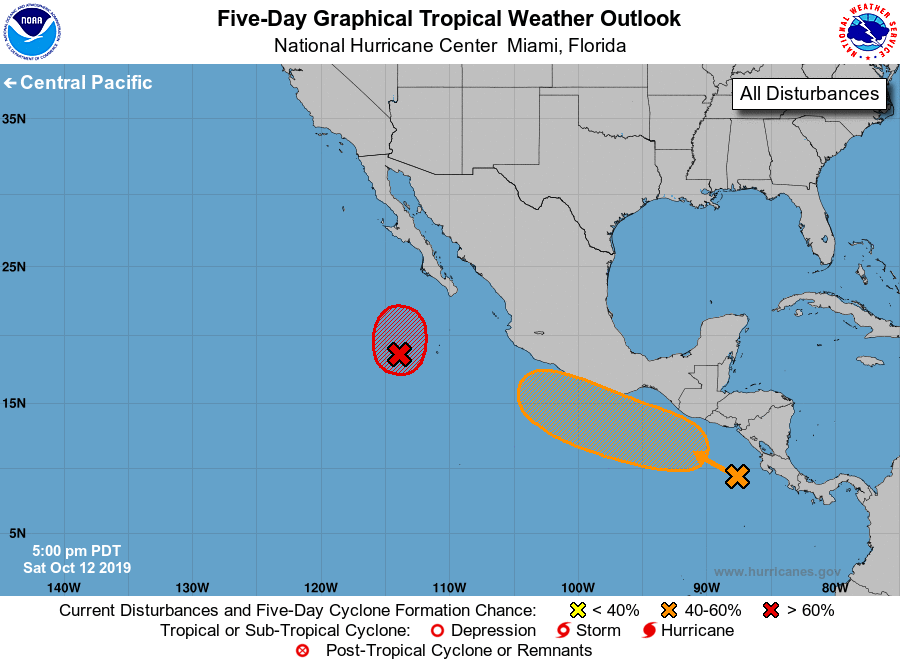
For the eastern North Pacific...east of 140 degrees west longitude:
1. Recent satellite data indicate that the wind field of a broad area
of low pressure located several hundred miles southwest of the
southern tip of the Baja California peninsula remains elongated, and
the system does not have a well-defined center. In addition, the
associated shower and thunderstorm activity has not increased in
organization. Although the window of opportunity for development is
decreasing, a tropical depression is still likely to form by tonight
or on Sunday while the system moves northward at 5 to 10 mph. By
Sunday night or Monday, however, additional development is not
expected due to cooler waters and stronger upper-level winds.
* Formation chance through 48 hours...high...70 percent.
* Formation chance through 5 days...high...70 percent.
2. A broad area of low pressure is forming a couple of hundred miles
west of the the coasts of Nicaragua and Costa Rica. Gradual
development of this system is possible over the next several days,
and a tropical depression could form by midweek while it moves
west-northwestward at about 10 mph near or just off the coast of
Mexico.
* Formation chance through 48 hours...low...near 0 percent.
* Formation chance through 5 days...medium...60 percent.
Forecaster Berg