ZCZC MIATWOEP ALL
TTAA00 KNHC DDHHMM
Tropical Weather Outlook
NWS National Hurricane Center Miami FL
1100 PM PDT Sun Oct 15 2017
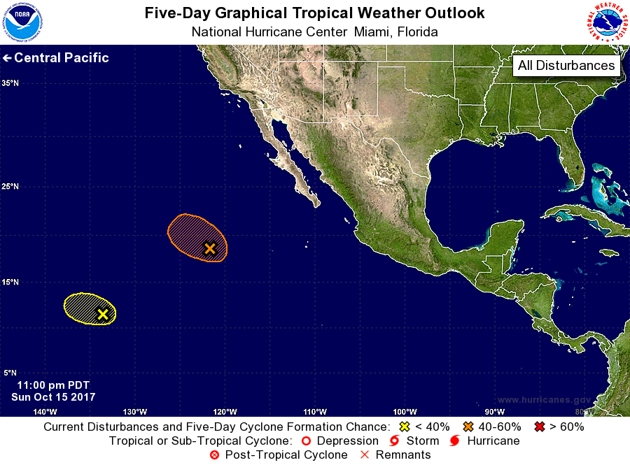
For the eastern North Pacific...east of 140 degrees west longitude:
1. Shower and thunderstorm activity associated with a low pressure
system located about 800 miles west-southwest of the southern tip of
the Baja California peninsula has changed little over the past
several hours. This system is forecast to move west-northwestward
or northwestward into less conducive environmental conditions on
Monday, and the chance of this system becoming a tropical cyclone
appears to be decreasing.
* Formation chance through 48 hours...medium...50 percent.
* Formation chance through 5 days...medium...50 percent.
2. Another low pressure area located about 1500 miles east-southeast
of the Hawaiian Islands is producing disorganized showers and
thunderstorms. Strong upper-level winds and proximity to dry air
are expected to inhibit significant development of this system while
it moves westward at 10 to 15 mph during the next couple of days.
* Formation chance through 48 hours...low...10 percent.
* Formation chance through 5 days...low...10 percent.
Forecaster Stewart