ZCZC MIATWOEP ALL
TTAA00 KNHC DDHHMM
Tropical Weather Outlook
NWS National Hurricane Center Miami FL
500 AM PDT Mon Oct 16 2017
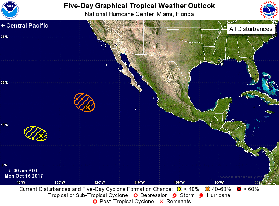
For the eastern North Pacific...east of 140 degrees west longitude:
1. A low pressure system is located about 850 miles west-southwest of
the southern tip of the Baja California peninsula. The associated
showers and thunderstorms have increased and become a little better
organized overnight, and only a small increase in organization
could result in the formation of a tropical depression this
morning. The system is forecast to move west-northwestward to
northwestward into less favorable environmental conditions later
today which should hinder additional development after that time.
* Formation chance through 48 hours...medium...50 percent.
* Formation chance through 5 days...medium...50 percent.
2. Another low pressure area located about 1500 miles east-southeast
of the Hawaiian Islands is producing disorganized showers and
thunderstorms. Strong upper-level winds and proximity to dry air
are expected to inhibit significant development of this system while
it moves westward at 10 to 15 mph during the next couple of days.
* Formation chance through 48 hours...low...10 percent.
* Formation chance through 5 days...low...10 percent.
Forecaster Brown