ZCZC MIATWOAT ALL
TTAA00 KNHC DDHHMM
Tropical Weather Outlook
NWS National Hurricane Center Miami FL
800 PM EDT Fri Aug 11 2017
For the North Atlantic...Caribbean Sea and the Gulf of Mexico:
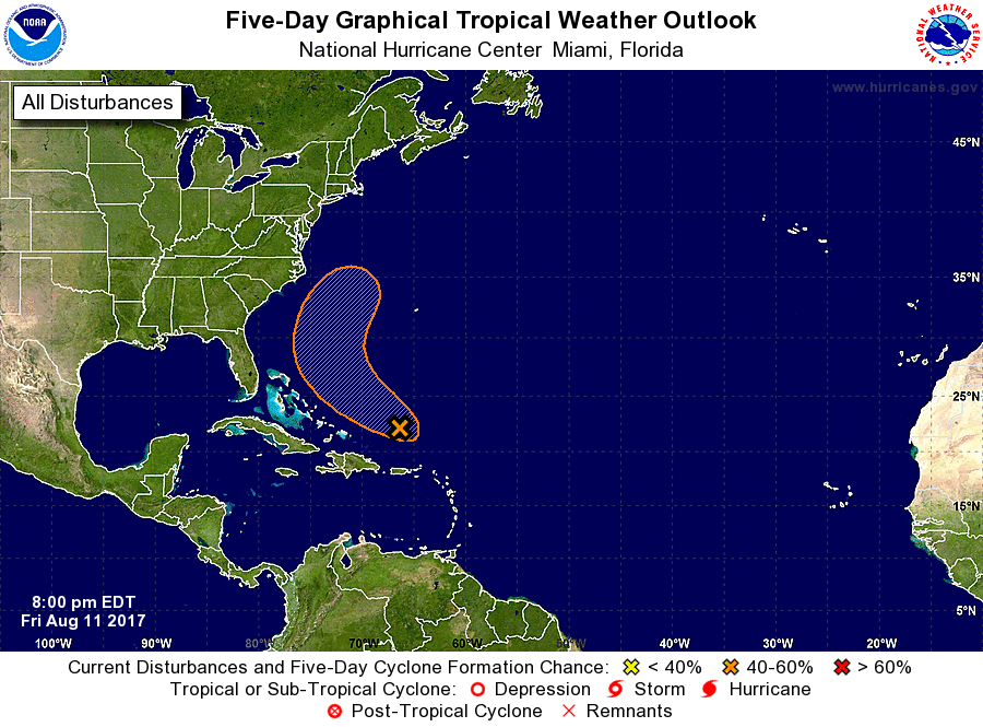
1. Showers and thunderstorms associated with a broad area of low
pressure located about 300 miles east of the Turks and Caicos
Islands have changed little in organization since this morning.
Dry air aloft and unfavorable upper-level winds have limited
significant development during the past few days. Environmental
conditions, however, are expected to become a little more conducive
for development during the next day or two, and this system could
become a tropical depression over the weekend. The low is forecast
to move generally northwestward through the weekend and is likely
to turn northeastward away from the United States early next week.
* Formation chance through 48 hours...medium...40 percent.
* Formation chance through 5 days...medium...60 percent.
Forecaster Brown