ZCZC MIATWOAT ALL
TTAA00 KNHC DDHHMM
TROPICAL WEATHER OUTLOOK
NWS NATIONAL HURRICANE CENTER MIAMI FL
200 AM EDT SUN SEP 25 2016
For the North Atlantic...Caribbean Sea and the Gulf of Mexico:
The National Hurricane Center is issuing advisories on Tropical
Storm Karl, located east-northeast of Bermuda, and has issued the
last advisory on Post-Tropical Cyclone Lisa, located over the
eastern tropical Atlantic.
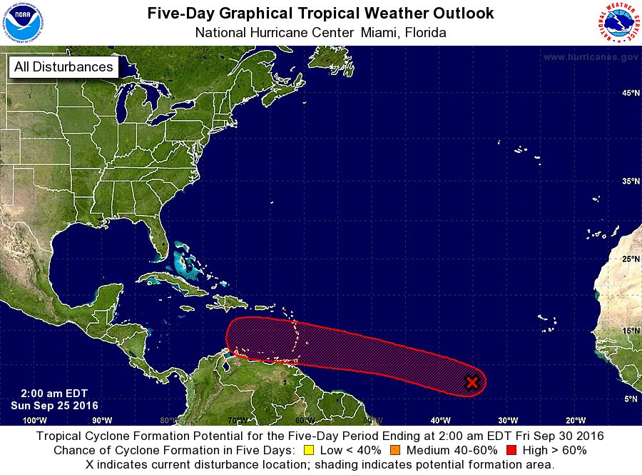
1. Shower and thunderstorm activity has developed in association with
a tropical wave and a low pressure system located several hundred
miles southwest of the Cabo Verde Islands. This disturbance is
forecast to move westward to west-northwestward across the tropical
Atlantic Ocean at 15 to 20 mph for the next several days.
Environmental conditions are expected to be conducive for gradual
development as the system, and a tropical depression could form
while the system approaches the Lesser Antilles by midweek.
* Formation chance through 48 hours...low...20 percent
* Formation chance through 5 days...high...80 percent
Forecaster Stewart