ZCZC MIATWOEP ALL
TTAA00 KNHC DDHHMM
TROPICAL WEATHER OUTLOOK
NWS NATIONAL HURRICANE CENTER MIAMI FL
1100 PM PDT SAT SEP 24 2016
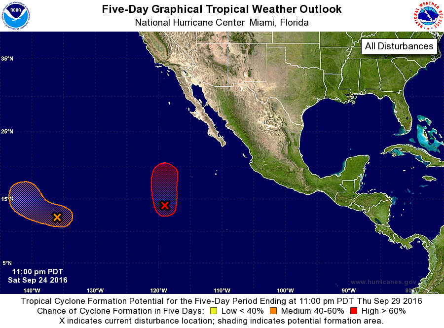
For the eastern North Pacific...east of 140 degrees west longitude:
1. A low pressure system located about 850 miles southwest of the
southern tip of Baja California Sur continues to produce a large
area of showers and thunderstorms. Environmental conditions are
forecast to be conducive for development while the system moves
slowly northward, and a tropical depression is expected to form on
Sunday.
* Formation chance through 48 hours...high...90 percent
* Formation chance through 5 days...high...90 percent
2. Showers and thunderstorms associated with an area of low pressure
located about 1300 miles east-southeast of the Big Island of Hawaii
have changed little during the past several hours. Any development
of this disturbance should be slow to occur for the next couple of
days. After that time, environmental conditions are forecast to
become more conducive for further development of the low. This
system is expected to move west-northwestward during the next couple
of days, and then turn northward as it approaches the Central
Pacific basin.
* Formation chance through 48 hours...low...10 percent
* Formation chance through 5 days...medium...50 percent
Forecaster Stewart