ZCZC MIATWOAT ALL
TTAA00 KNHC DDHHMM
TROPICAL WEATHER OUTLOOK
NWS NATIONAL HURRICANE CENTER MIAMI FL
800 PM EDT SAT SEP 24 2016
For the North Atlantic...Caribbean Sea and the Gulf of Mexico:
The National Hurricane Center is issuing advisories on Tropical
Storm Karl, located east-northeast of Bermuda, and on recently
downgraded again Tropical Depression Lisa, located over the eastern
tropical Atlantic.
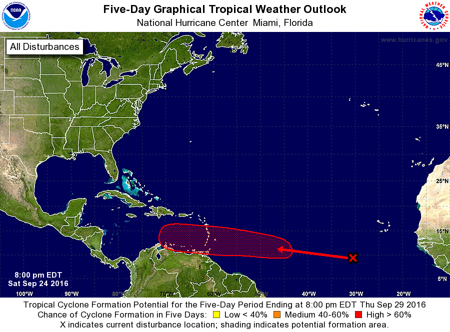
1. A tropical wave, accompanied by a broad area of low pressure, is
located several hundred miles southwest of the Cabo Verde Islands.
This disturbance is expected to move rapidly westward across the
tropical Atlantic Ocean at 20 to 25 mph for the next several days.
Environmental conditions are expected to become conducive for
gradual development as the system moves into the western tropical
Atlantic early next week, and a tropical depression could form
while the system approaches the Lesser Antilles and moves into the
Caribbean Sea by the middle of next week.
* Formation chance through 48 hours...low...10 percent
* Formation chance through 5 days...high...70 percent
Forecaster Beven