ZCZC MIATWOEP ALL
TTAA00 KNHC DDHHMM
Tropical Weather Outlook
NWS National Hurricane Center Miami FL
1100 PM PDT Mon Sep 6 2021
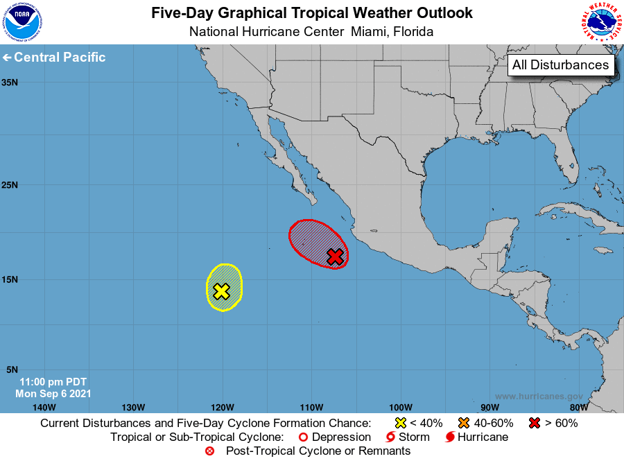
For the eastern North Pacific...east of 140 degrees west longitude:
1. Showers and thunderstorms associated with an area of low pressure
located a couple of hundred miles south-southwest of Manzanillo,
Mexico, continue to show some signs of organization. Although
recent satellite wind data indicate that the circulation remains
broad, environmental conditions are conducive for additional
development, and this system is likely to become a tropical
depression during the next day or so while it moves generally
west-northwestward at 5 to 10 mph, just offshore of the coast of
Mexico. Regardless of development, outer rainbands from the
disturbance are likely to produce locally heavy rainfall and gusty
winds along the coast of the Mexican states of Colima and Jalisco
through Tuesday.
* Formation chance through 48 hours...high...90 percent.
* Formation chance through 5 days...high...90 percent.
2. A small low pressure area located about 900 miles southwest
of the southern tip of the Baja California peninsula is producing
disorganized showers and thunderstorms. Development, if any, of
this system is likely to be slow over the next day or two while it
drifts northward. After that time, environmental conditions are
expected to become unfavorable for further development.
* Formation chance through 48 hours...low...10 percent.
* Formation chance through 5 days...low...10 percent.
Forecaster Brown