ZCZC MIATWOEP ALL
TTAA00 KNHC DDHHMM
Tropical Weather Outlook
NWS National Hurricane Center Miami FL
Issued by the NWS Weather Prediction Center College Park MD
1100 AM PDT Mon Sep 17 2018
For the eastern North Pacific...east of 140 degrees west longitude:
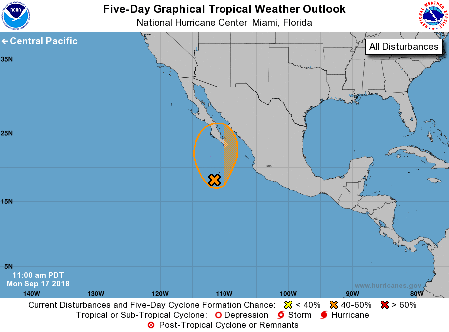
1. An elongated area of low pressure was located about 250 miles
south of the southern tip of Baja California, producing
disorganized clusters of showers and thunderstorms. Environmental
conditions appear conducive for tropical cyclone formation, although
the broad nature of the system and potential interaction with
land as it moves northward may hamper development. This system
could become a tropical depression on Wednesday or Thursday as it
approaches Baja California Sur. Regardless of development, this
system will likely produce very heavy rainfall over Baja California
Sur and other parts of northwestern Mexico later this week.
* Formation chance through 48 hours...medium...40 percent.
* Formation chance through 5 days...medium...60 percent.
Forecast Burke/Blake