ZCZC MIATWOEP ALL
TTAA00 KNHC DDHHMM
Tropical Weather Outlook
NWS National Hurricane Center Miami FL
500 AM PDT Mon Sep 17 2018
For the eastern North Pacific...east of 140 degrees west longitude:
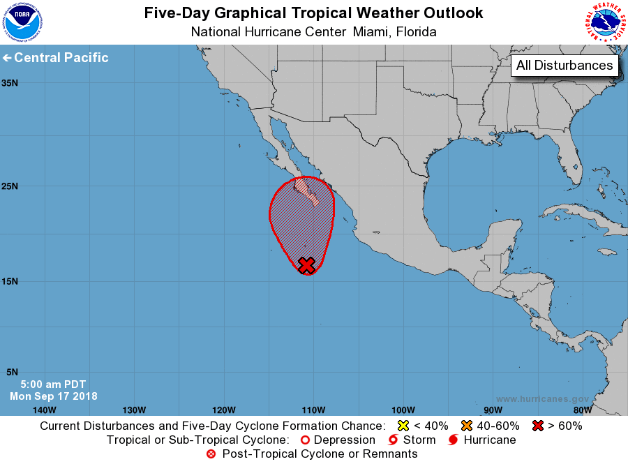
1. A broad and elongated area of low pressure located a few hundred
miles south of the southern tip of the Baja California
peninsula continues to produce widespread but disorganized showers
and thunderstorms. Although environmental conditions appear
conducive for tropical cyclone formation, the large size of the
system suggests that any development should be slow to occur. This
system will likely become a tropical depression later this week
while it moves generally northward at about 10 mph. Interests in
Baja California Sur should monitor the progress of this disturbance.
* Formation chance through 48 hours...low...30 percent.
* Formation chance through 5 days...high...70 percent.
Forecaster Cangialosi/Latto