


NHC Graphical Outlook Archive
|
« Earliest Available ‹ Earlier Later › Latest Available » |
GIS Shapefiles |
| Eastern Pacific | Atlantic |
|
Tropical Weather Outlook Text
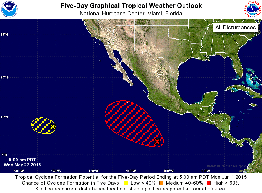
ZCZC MIATWOEP ALL
TTAA00 KNHC DDHHMM

TROPICAL WEATHER OUTLOOK
NWS NATIONAL HURRICANE CENTER MIAMI FL
500 AM PDT WED MAY 27 2015

For the eastern North Pacific...east of 140 degrees west longitude:

1. Showers and thunderstorms in association with a broad area of
low pressure located several hundred miles south-southwest of the
coast of Mexico have become better organized.  Environmental
conditions appear conducive for development of this system and a
tropical depression is likely to form in the next couple of days as
the system moves slowly west-northwestward to northwestward.
* Formation chance through 48 hours...medium...60 percent
* Formation chance through 5 days...high...90 percent

2. A nearly stationary area of low pressure located about 1500 miles
west-southwest of the southern tip of Baja California continues to
produce a small area of showers and thunderstorms to the east
of the center.  Environmental conditions are expected to become less
favorable over the next day or so, and significant development of
this system is not expected.
* Formation chance through 48 hours...low...10 percent
* Formation chance through 5 days...low...10 percent

Forecaster Roberts/Brown
List of Atlantic Outlooks (May 2023 - present)
List of East Pacific Outlooks (May 2023 - present)
List of Central Pacific Outlooks (May 2023 - present)
List of Atlantic Outlooks (July 2014 - April 2023)
List of East Pacific Outlooks (July 2014 - April 2023)
List of Central Pacific Outlooks (June 2019 - April 2023)
List of Atlantic Outlooks (June 2009 - June 2014)
List of East Pacific Outlooks (June 2009 - June 2014)