ZCZC MIATWOAT ALL
TTAA00 KNHC DDHHMM
Tropical Weather Outlook
NWS National Hurricane Center Miami FL
800 AM EDT Sun Oct 23 2022
For the North Atlantic...Caribbean Sea and the Gulf of Mexico:
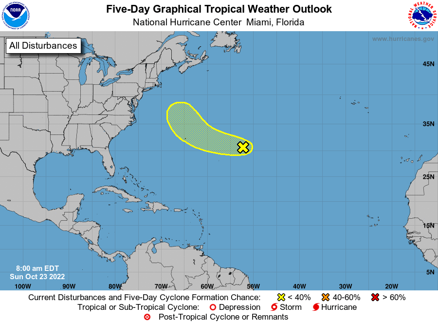
1. Central Subtropical Atlantic:
A trough of low pressure located well to the east of Bermuda
continues to produce disorganized shower and thunderstorm activity.
Although environmental conditions appear only marginally conducive
for development during the next few days, the disturbance could
still acquire some subtropical or tropical characteristics while it
moves generally west-northwestward at 15 to 20 mph across the
subtropical Atlantic. By the middle part of this week, further
development appears unlikely as the system turns northward over the
cooler waters of the northwestern Atlantic and encounters stronger
upper-level winds.
* Formation chance through 48 hours...low...10 percent.
* Formation chance through 5 days...low...20 percent.
Forecaster Brown/Bucci