ZCZC MIATWOAT ALL
TTAA00 KNHC DDHHMM
Tropical Weather Outlook
NWS National Hurricane Center Miami FL
200 PM EDT Mon Aug 8 2022
For the North Atlantic...Caribbean Sea and the Gulf of Mexico:
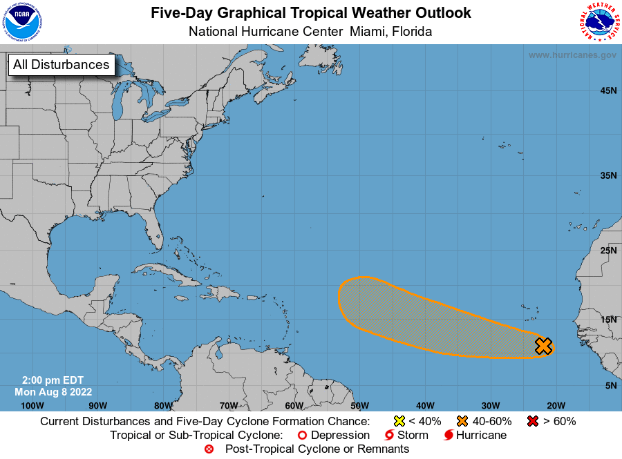
1. Eastern Tropical Atlantic:
A large area of showers and thunderstorms over the far eastern
tropical Atlantic south of the Cabo Verde islands is associated with
a tropical wave. This system has changed little in organization
today, but environmental conditions appear conducive for gradual
development over the next several days while it moves westward to
west-northwestward at 15 to 20 mph across the eastern and central
tropical Atlantic. A tropical depression could form by the middle to
latter portion of this week before environmental conditions become
less favorable by this weekend.
* Formation chance through 48 hours...low...20 percent.
* Formation chance through 5 days...medium...40 percent.
Forecaster Papin