ZCZC MIATWOAT ALL
TTAA00 KNHC DDHHMM
Tropical Weather Outlook
NWS National Hurricane Center Miami FL
200 AM EDT Fri Aug 13 2021
For the North Atlantic...Caribbean Sea and the Gulf of Mexico:
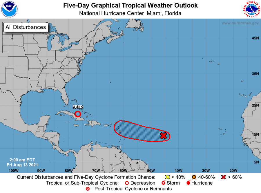
The National Hurricane Center is issuing advisories on Tropical
Depression Fred, located about 180 miles south-southeast of southern
Andros Island, Bahamas.
1. A small low pressure system located about 1000 miles east of the
Lesser Antilles is producing disorganized shower and thunderstorm
activity primarily west of the center. Environmental conditions are
expected to gradually become more conducive for additional
development, and a tropical depression is likely to form within the
next couple of days. The system is forecast to move generally
westward at about 20 mph across the tropical Atlantic, reaching
portions of the Leeward Islands Saturday night, and Virgin Islands
on Sunday. Interests in these locations should monitor the progress
of this disturbance.
* Formation chance through 48 hours...high...70 percent.
* Formation chance through 5 days...high...70 percent.
Forecaster Latto