ZCZC MIATWOEP ALL
TTAA00 KNHC DDHHMM
Tropical Weather Outlook
NWS National Hurricane Center Miami FL
500 AM PDT Wed Jun 16 2021
For the eastern North Pacific...east of 140 degrees west longitude:
The National Hurricane Center is issuing advisories on Tropical
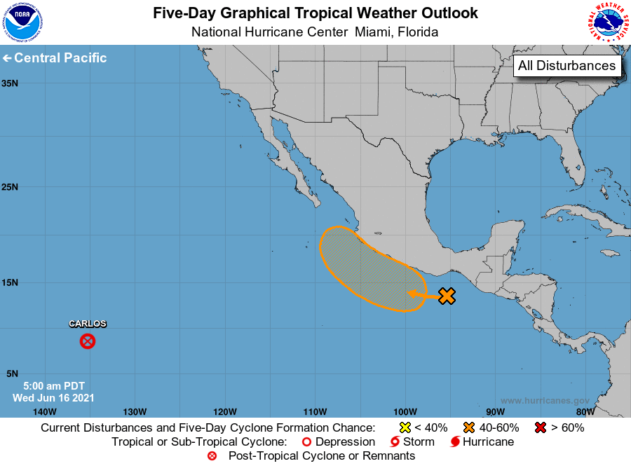
Depression Carlos, located about 1900 miles west-southwest of the
southern tip of the Baja California peninsula.
1. Disorganized showers and thunderstorms located a few hundred miles
south of the coast of southern Mexico are associated with a broad
trough of low pressure. A low-pressure system is expected to
develop along this trough within the next couple of days, and
environmental conditions should be favorable for gradual development
of this disturbance later this week. A tropical depression could
form by the weekend while the system moves west-northwestward at 5
to 10 mph, offshore of and parallel to the southwestern coast of
Mexico. Regardless of development, heavy rains are likely over the
Mexican states of Oaxaca, Guerrero, and Michoacan during the next
few days, and these rains could cause life-threatening flash floods
and mud slides.
* Formation chance through 48 hours...low...20 percent.
* Formation chance through 5 days...medium...60 percent.
Forecaster Berg