ZCZC MIATWOEP ALL
TTAA00 KNHC DDHHMM
Tropical Weather Outlook
NWS National Hurricane Center Miami FL
500 AM PDT Mon Jun 7 2021
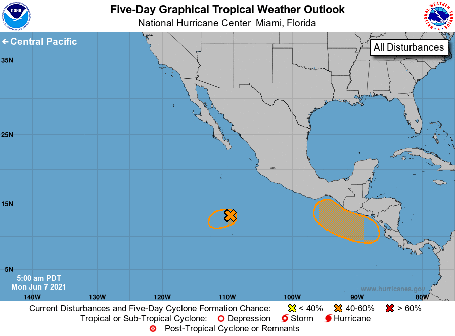
For the eastern North Pacific...east of 140 degrees west longitude:
1. Showers and thunderstorms continue in association with an area of
low pressure located about 400 miles south-southeast of Socorro
Island. However, the system still lacks a well-defined center, as
recent satellite imagery indicates the low-level circulation remains
broad and displaced well east of the thunderstorm activity. The
disturbance still has the potential to become a short-lived tropical
depression today before environmental conditions become less
favorable for development by tonight. The system is forecast to
move slowly west-southwestward during the next couple of days.
* Formation chance through 48 hours...medium...60 percent.
* Formation chance through 5 days...medium...60 percent.
2. A broad trough of low pressure is expected to form a couple of
hundred miles south of the coasts of southern Mexico, El Salvador,
and Guatemala in a day or two. Environmental conditions appear
favorable for some development thereafter, and a tropical depression
could form by the end of the week as the system moves slowly
northwestward or northward.
* Formation chance through 48 hours...low...near 0 percent.
* Formation chance through 5 days...medium...40 percent.
Forecaster Reinhart/Blake