ZCZC MIATWOEP ALL
TTAA00 KNHC DDHHMM
Tropical Weather Outlook
NWS National Hurricane Center Miami FL
500 AM PDT Sat May 29 2021
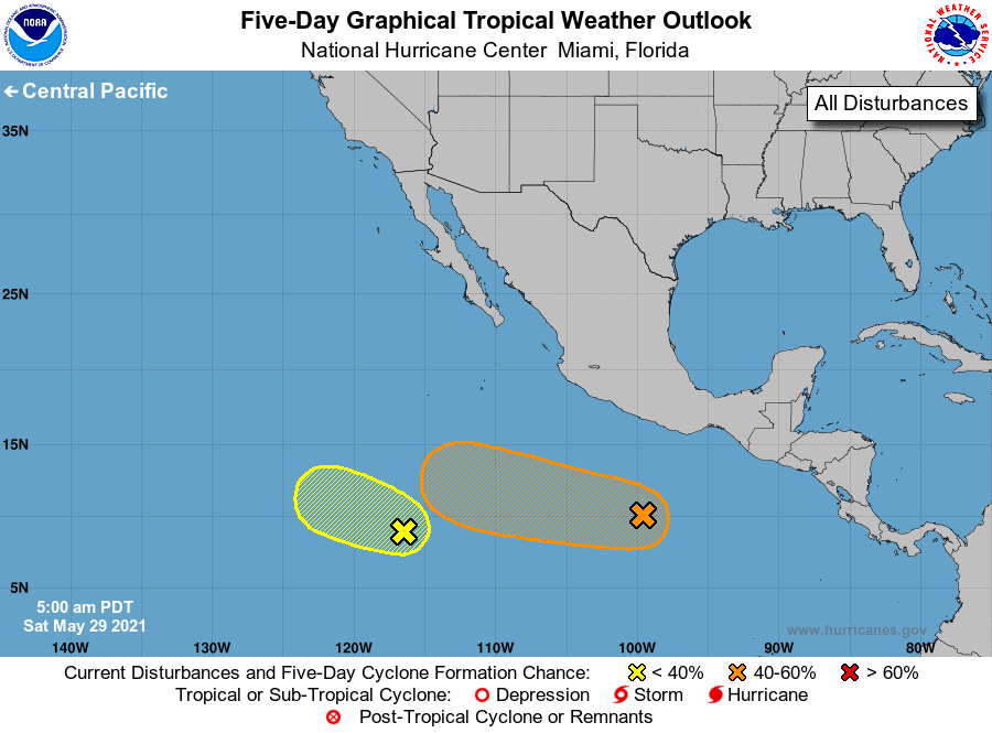
For the eastern North Pacific...east of 140 degrees west longitude:
1. A small cluster of showers and thunderstorms located about 1000
miles south-southwest of the southern tip of the Baja California
peninsula is associated with a weak area of low pressure. This
system is moving westward at 5 to 10 mph, and some slow development
remains possible over the next few days before it moves into a drier
and more stable airmass by early next week.
* Formation chance through 48 hours...low...20 percent.
* Formation chance through 5 days...low...30 percent.
2. A broad area of low pressure located several hundred miles south of
Acapulco, Mexico, is producing disorganized shower and thunderstorm
activity. Environmental conditions are expected to be conducive for
gradual development of this system during the next several days, and
a tropical depression could form by the middle of next week while
the system moves westward to west-northwestward at about 10 mph.
* Formation chance through 48 hours...low...20 percent.
* Formation chance through 5 days...medium...50 percent.
Forecaster Berg