ZCZC MIATWOEP ALL
TTAA00 KNHC DDHHMM
Tropical Weather Outlook
NWS National Hurricane Center Miami FL
1100 PM PDT Mon Oct 12 2020
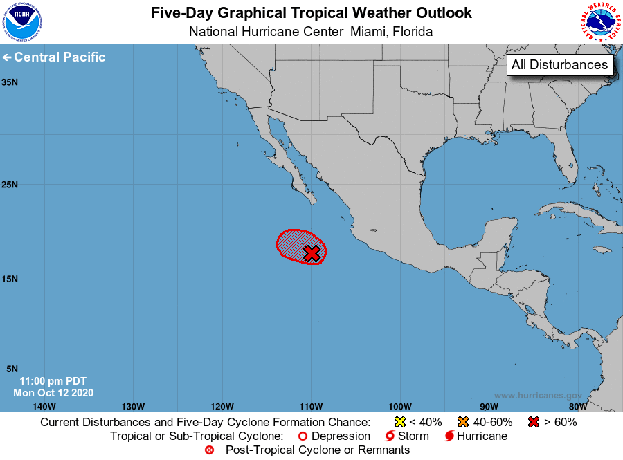
For the eastern North Pacific...east of 140 degrees west longitude:
1. An area of low pressure, associated in part with the remnants of
Norbert, is located less than 100 miles east-southeast of Socorro
Island, Mexico. Satellite imagery and recent satellite-derived
surface wind data indicate that the low has continued to become
better defined, while associated showers and thunderstorms have
increased and become better organized. If this recent development
trend continues, then a short-lived tropical depression could form
on Tuesday while the low moves slowly west-northwestward. By
Wednesday, however, environmental conditions are forecast to become
less conducive for development.
* Formation chance through 48 hours...high...70 percent.
* Formation chance through 5 days...high...70 percent.
Forecaster Stewart