ZCZC MIATWOEP ALL
TTAA00 KNHC DDHHMM
Tropical Weather Outlook
NWS National Hurricane Center Miami FL
500 PM PDT Mon Oct 12 2020
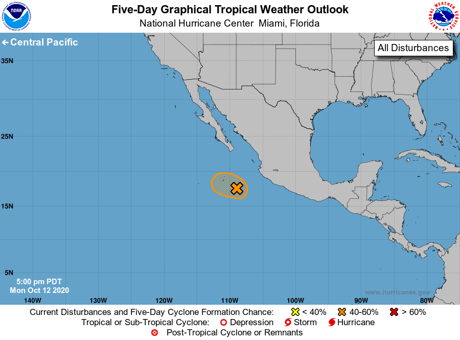
For the eastern North Pacific...east of 140 degrees west longitude:
1. An area of low pressure, associated in part with the remnants of
Norbert, is located a few hundred miles southwest of the coast of
southwestern Mexico. Satellite imagery and satellite-derived surface
winds suggest that the low is a little better defined than it was
yesterday, but the associated showers and thunderstorms remain
somewhat disorganized. However, this system could still become a
short-lived tropical depression while it moves west-northwestward
during the next day or so before environmental conditions become
less favorable for development.
* Formation chance through 48 hours...medium...60 percent.
* Formation chance through 5 days...medium...60 percent.
Forecaster Stewart