ZCZC MIATWOAT ALL
TTAA00 KNHC DDHHMM
Tropical Weather Outlook
NWS National Hurricane Center Miami FL
800 PM EDT Mon Jul 27 2020
For the North Atlantic...Caribbean Sea and the Gulf of Mexico:
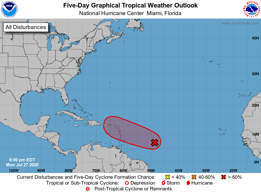
1. Shower activity associated with a low pressure area located about
850 miles east of the Windward Islands has again become a little
better organized, however the low's circulation remains broad
without a well-defined center of circulation. Environmental
conditions are expected to become somewhat more conducive for
development, and a tropical depression or tropical storm is likely
to form during the next couple of days while the system moves
west-northwestward at 15 to 20 mph and approaches the Leeward
Islands. Regardless of development, locally heavy rains and gusty
winds are likely across portions of the Leeward Islands on Wednesday
and will spread westward to the Virgin Islands and Puerto Rico
Wednesday night and Thursday. Interests on these islands should
continue to monitor the progress of this system, and tropical storm
watches or warnings could be required for portions of the area on
Tuesday.
* Formation chance through 48 hours...high...70 percent.
* Formation chance through 5 days...high...80 percent.
Forecaster Berg