ZCZC MIATWOAT ALL
TTAA00 KNHC DDHHMM
Tropical Weather Outlook
NWS National Hurricane Center Miami FL
200 AM EDT Sun Jul 19 2020
For the North Atlantic...Caribbean Sea and the Gulf of Mexico:
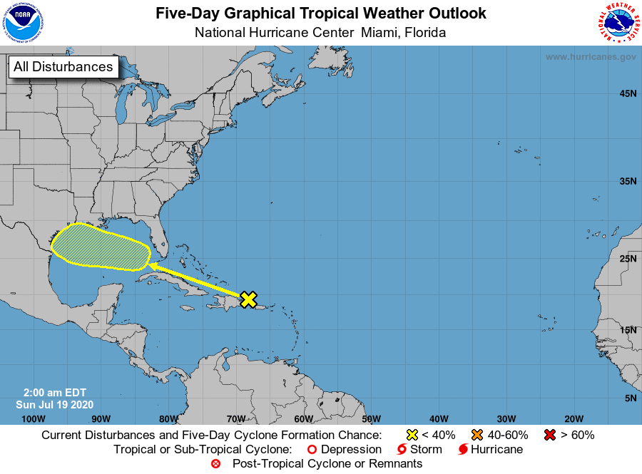
1. A tropical wave located over eastern Hispaniola and the adjacent
waters of the southwestern Atlantic is expected to move
west-northwestward over the next several days and enter the
southeastern Gulf of Mexico by late Tuesday, and then move across
the central Gulf on Wednesday and reach the northwestern Gulf on
Thursday. This disturbance is currently producing only minimal
shower activity, but environmental conditions are expected to become
at least marginally conducive for development by Wednesday or
Thursday.
* Formation chance through 48 hours...low...near 0 percent.
* Formation chance through 5 days...low...20 percent.
Forecaster Stewart