ZCZC MIATWOEP ALL
TTAA00 KNHC DDHHMM
Tropical Weather Outlook
NWS National Hurricane Center Miami FL
500 PM PDT Sun Jul 5 2020
For the eastern North Pacific...east of 140 degrees west longitude:
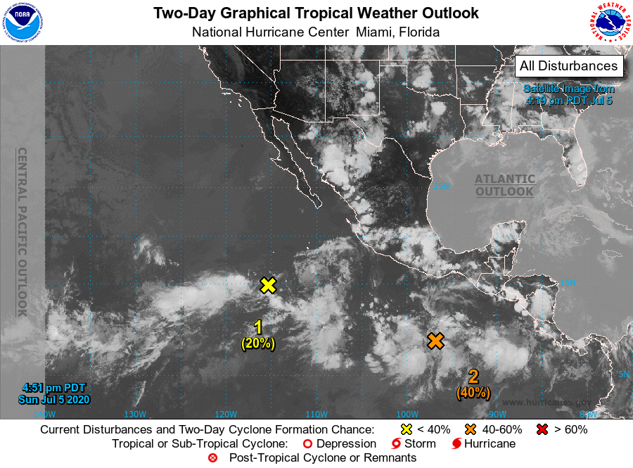
1. An elongated area of low pressure located several hundred miles
south-southwest of the southern tip of the Baja California
peninsula continues to produce a large area of disorganized showers
and a few thunderstorms. Any development of this system should be
slow to occur over the next couple of days while it moves slowly
west-northwestward.
* Formation chance through 48 hours...low...20 percent.
* Formation chance through 5 days...low...20 percent.
2. A broad low pressure system located several hundred miles south
and south-southwest of the Gulf of Tehuantepec is producing a
large but disorganized area of showers and thunderstorms. However,
environmental conditions are expected to be conducive for
development over the next several days, and a tropical depression is
likely to form by the middle of the week while the system moves
west-northwestward, well south of the coast of southern Mexico.
* Formation chance through 48 hours...medium...40 percent.
* Formation chance through 5 days...high...90 percent.
Forecaster Stewart