ZCZC MIATWOEP ALL
TTAA00 KNHC DDHHMM
Tropical Weather Outlook
NWS National Hurricane Center Miami FL
500 PM PDT Sun Jun 28 2020
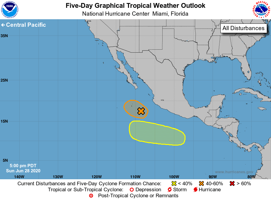
For the eastern North Pacific...east of 140 degrees west longitude:
1. Showers and thunderstorms associated with a trough of low pressure
located a few hundred miles west of the coast of southwestern Mexico
have become better organized today. Although the system does not
currently have a well-defined center, additional development is
possible, and a tropical depression could form tonight or Monday as
the system moves northwestward at about 15 mph. After that time,
additional development will become unlikely as the disturbance moves
over cooler waters.
* Formation chance through 48 hours...medium...50 percent.
* Formation chance through 5 days...medium...50 percent.
2. An area of low pressure is likely to form a few hundred miles
south-southwest of the Gulf of Tehuantepec by the middle of the
week. Environmental conditions are then forecast to be conducive
for slow development while the system moves west-northwestward at
10 to 15 mph well south of Mexico.
* Formation chance through 48 hours...low...near 0 percent.
* Formation chance through 5 days...low...20 percent.
Forecaster Latto