ZCZC MIATWOAT ALL
TTAA00 KNHC DDHHMM
Tropical Weather Outlook
NWS National Hurricane Center Miami FL
200 AM EDT Tue Oct 29 2019
For the North Atlantic...Caribbean Sea and the Gulf of Mexico:
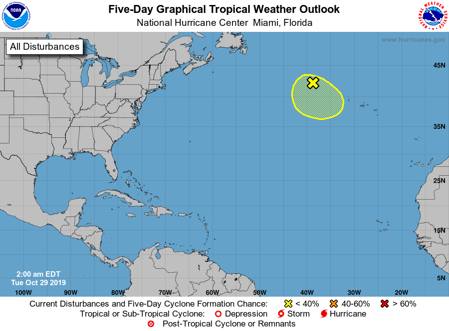
1. Showers and thunderstorms have become a little more concentrated
near the center of a large non-tropical low pressure area located
several hundred miles west-northwest of the Azores. Recent
satellite wind data indicate that the low continues to produce a
large area of gale to storm-force winds. This system could acquire
some subtropical characteristics over the next two to three days
while it moves slowly southward to southeastward over slightly
warmer water. Environmental conditions are expected to become
unfavorable for any further development Thursday night when the low
is forecast to move back over colder water. For more information of
this system, see High Seas Forecasts issued by the National Weather
Service.
* Formation chance through 48 hours...low...20 percent.
* Formation chance through 5 days...low...30 percent.
High Seas Forecasts issued by the National Weather Service can be
found under AWIPS header NFDHSFAT1, WMO header FZNT01 KWBC, and
online at ocean.weather.gov/shtml/NFDHSFAT1.php.
Forecaster Brown