ZCZC MIATWOEP ALL
TTAA00 KNHC DDHHMM
Special Tropical Weather Outlook
NWS National Hurricane Center Miami FL
1235 AM PDT Sun Oct 20 2019
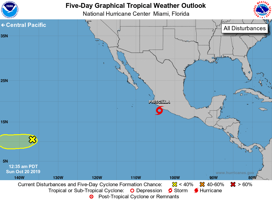
For the eastern North Pacific...east of 140 degrees west longitude:
Special outlook issued to update discussion for the system near the
west-central coast of Mexico.
1. Recent satellite wind data and conventional satellite imagery
indicate that the area of low pressure located near the west-central
coast of Mexico has become better organized and is producing winds
to near tropical storm strength. Some additional development is
possible and this system has the potential to become a short-lived
tropical depression or storm this morning or later today before
it moves inland by Sunday night. Regardless of whether or not this
system becomes a tropical cyclone, heavy rainfall associated with
this disturbance could produce flash flooding and mudslides across
portions of Michoacan, Colima, and Jalisco, especially in areas of
mountainous terrain, during the next couple of days.
* Formation chance through 48 hours...high...70 percent.
* Formation chance through 5 days...high...70 percent.
2. An elongated area of low pressure located over the far southwestern
portion of the eastern Pacific basin is also producing disorganized
showers and thunderstorms. Any development of this system should be
slow to occur while it drifts westward during the next few days.
This system is expected to move into the central Pacific basin by
late Sunday.
* Formation chance through 48 hours...low...20 percent.
* Formation chance through 5 days...low...20 percent.
Forecaster Brown