ZCZC MIATWOAT ALL
TTAA00 KNHC DDHHMM
Tropical Weather Outlook
NWS National Hurricane Center Miami FL
200 PM EDT Wed Sep 25 2019
For the North Atlantic...Caribbean Sea and the Gulf of Mexico:
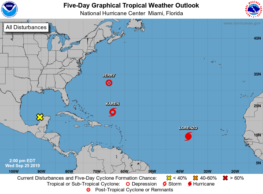
The National Hurricane Center is issuing advisories on Post-Tropical
Cyclone Jerry, located just to the west of Bermuda, on Tropical
Storm Karen, located a few hundred miles north-northeast of Puerto
Rico, and on Tropical Storm Lorenzo, located over the eastern
tropical Atlantic.
1. A weak area of low pressure located just offshore of the
northwestern coast of the Yucatan peninsula continues to produce
limited shower activity. Development of this system is not
expected while it moves westward at about 5 mph across the
southwestern Gulf of Mexico. The disturbance is expected to move
inland over northeastern Mexico on Saturday.
* Formation chance through 48 hours...low...near 0 percent.
* Formation chance through 5 days...low...near 0 percent.
Forecaster Berg