ZCZC MIATWOEP ALL
TTAA00 KNHC DDHHMM
Tropical Weather Outlook
NWS National Hurricane Center Miami FL
1100 PM PDT Tue Sep 24 2019
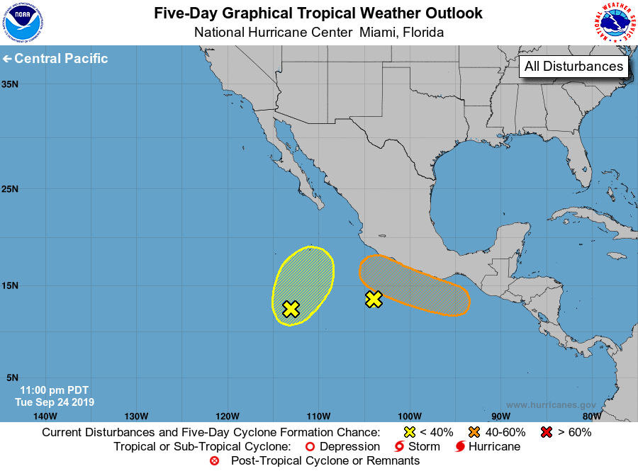
For the eastern North Pacific...east of 140 degrees west longitude:
1. A weak area of low pressure located a couple of hundred miles south
of the southwestern coast of Mexico continues to produce limited
showers and thunderstorms. Significant development of this system is
not expected while it slowly moves northward for the next day or so.
* Formation chance through 48 hours...low...near 0 percent.
* Formation chance through 5 days...low...near 0 percent.
2. A broad area of low pressure several hundred miles south-southwest
of southern tip of the Baja California peninsula is generating
disorganized showers and a few thunderstorms. Some gradual
development of this system is possible during the next couple of
days while it moves slowly northward.
* Formation chance through 48 hours...low...20 percent.
* Formation chance through 5 days...low...20 percent.
3. An area of low pressure is expected to form within a couple hundred
miles of the southern coast of Mexico late this week. A tropical
depression could form over the weekend or early next week while the
system moves generally west-northwestward at 10 to 15 mph near the
southern and southwestern coasts of Mexico.
* Formation chance through 48 hours...low...near 0 percent.
* Formation chance through 5 days...medium...50 percent.
Forecaster Zelinsky/Ramos