ZCZC MIATWOEP ALL
TTAA00 KNHC DDHHMM
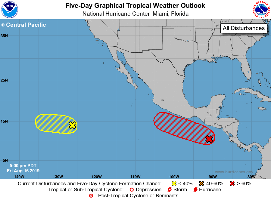
Tropical Weather Outlook
NWS National Hurricane Center Miami FL
500 PM PDT Fri Aug 16 2019
For the eastern North Pacific...east of 140 degrees west longitude:
1. An area of low pressure located a couple of hundred miles south of
the coast of Guatemala is producing a large area of disorganized
showers and thunderstorms. Environmental conditions are expected to
be conducive for development, and a tropical depression is likely to
form early next week while the low moves west-northwestward at about
10 mph parallel to the coast of Mexico. Regardless of development,
moisture associated with the low is forecast to produce heavy
rainfall and possible flash flooding across portions of Central
America and southeastern Mexico during the next few days.
* Formation chance through 48 hours...medium...40 percent.
* Formation chance through 5 days...high...80 percent.
2. A tropical wave is producing disorganized showers and thunderstorms
more than 1200 miles west-southwest of the southern tip of the Baja
California peninsula. Gradual development of this disturbance is
possible during the next few days while it moves slowly westward
across the tropical eastern Pacific.
* Formation chance through 48 hours...low...20 percent.
* Formation chance through 5 days...low...30 percent.
Forecaster Blake/Hagen