ZCZC MIATWOEP ALL
TTAA00 KNHC DDHHMM
Tropical Weather Outlook
NWS National Hurricane Center Miami FL
500 AM PDT Sun Jul 28 2019
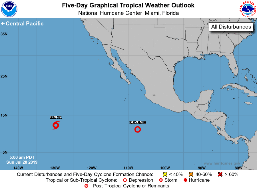
For the eastern North Pacific...east of 140 degrees west longitude:
The National Hurricane Center is issuing advisories on Tropical
Storm Erick, located between Mexico and the Hawaiian Islands.
1. Showers and thunderstorms associated with an area of low pressure
located several hundred miles south-southwest of Manzanillo,
Mexico, continue to show signs of organization. Conditions are
conducive for continued development of this system, and a tropical
depression is expected to form later today or on Monday while the
low moves westward at 15 to 20 mph.
* Formation chance through 48 hours...high...90 percent.
* Formation chance through 5 days...high...90 percent.
Public Advisories on Erick are issued under WMO header WTPZ31 KNHC
and under AWIPS header MIATCPEP1. Forecast/Advisories on Erick are
issued under WMO header WTPZ21 KNHC and under AWIPS header
MIATCMEP1.
Forecaster Berg