ZCZC MIATWOEP ALL
TTAA00 KNHC DDHHMM
Tropical Weather Outlook
NWS National Hurricane Center Miami FL
1100 PM PDT Thu Sep 13 2018
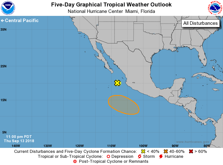
For the eastern North Pacific...east of 140 degrees west longitude:
1. A weak area of low pressure located a couple of hundred miles south
of the southern tip of the Baja California peninsula is producing
disorganized shower activity. Significant development of this
system is not expected while it drifts west-southwestward.
* Formation chance through 48 hours...low...near 0 percent.
* Formation chance through 5 days...low...near 0 percent.
2. An area of low pressure is expected to develop well south of the
southwestern coast of Mexico over the weekend. Thereafter,
environmental conditions appear conducive for gradual development,
and a tropical depression could form while the system moves
generally westward to west-northwestward at 10 to 15 mph south of
Mexico.
* Formation chance through 48 hours...low...near 0 percent.
* Formation chance through 5 days...medium...50 percent.
Forecaster Cangialosi