ZCZC MIATWOEP ALL
TTAA00 KNHC DDHHMM
Tropical Weather Outlook
NWS National Hurricane Center Miami FL
500 PM PDT Thu Sep 13 2018
For the eastern North Pacific...east of 140 degrees west longitude:
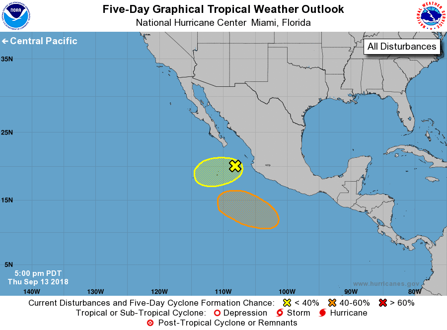
1. Shower activity associated with a broad area of low pressure
located a couple of hundred miles west-southwest of Cabo Corrientes,
Mexico, is diminishing. Upper-level winds are not particularly
conducive, so any development of this system should be slow to occur
over the next few days while the disturbance drifts
west-southwestward.
* Formation chance through 48 hours...low...10 percent.
* Formation chance through 5 days...low...10 percent.
2. An area of low pressure is expected to develop well south of the
southwestern coast of Mexico over the weekend. Thereafter,
environmental conditions appear conducive for gradual development,
and a tropical depression could form while the system moves
generally westward to west-northwestward at 10 to 15 mph south of
Mexico.
* Formation chance through 48 hours...low...near 0 percent.
* Formation chance through 5 days...medium...50 percent.
Forecaster Beven