ZCZC MIATWOEP ALL
TTAA00 KNHC DDHHMM
Tropical Weather Outlook
NWS National Hurricane Center Miami FL
1100 AM PDT Wed Jul 25 2018
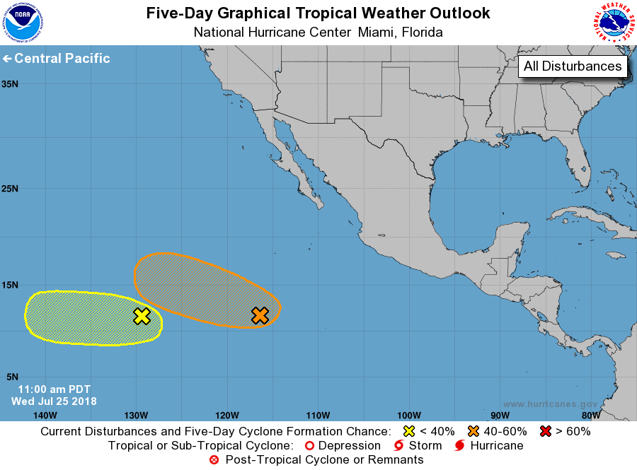
For the eastern North Pacific...east of 140 degrees west longitude:
1. A disorganized area of disturbed weather associated with an
elongated area of low pressure is located near 1000 miles south-
southwest of the southern tip of the Baja California peninsula.
Conditions are expected to become favorable for gradual development
during the next few days while the system moves toward the west or
west-northwest.
* Formation chance through 48 hours...low...30 percent.
* Formation chance through 5 days...medium...50 percent.
2. A small area of low pressure accompanied by limited shower activity
is located around 1500 miles southwest of the southern tip of the
Baja California peninsula. Some slight development is possible
today or tonight, but after that time, environmental conditions are
expected to become unfavorable for tropical cyclone formation as the
system moves generally westward.
* Formation chance through 48 hours...low...10 percent.
* Formation chance through 5 days...low...20 percent.
Forecaster Avila