ZCZC MIATWOEP ALL
TTAA00 KNHC DDHHMM
Tropical Weather Outlook
NWS National Hurricane Center Miami FL
500 AM PDT Mon Jul 16 2018
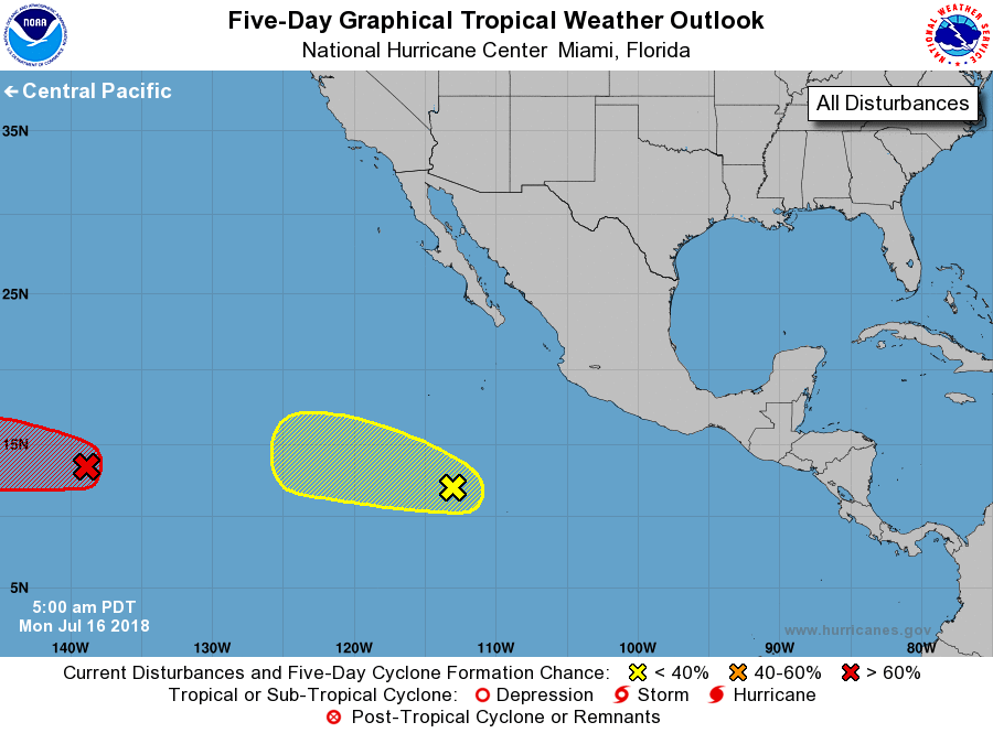
For the eastern North Pacific...east of 140 degrees west longitude:
1. Showers and thunderstorms in association with a low pressure system
located about 1150 miles east-southeast of the Big Island of Hawaii
continue to show signs of organization. Environmental conditions
are expected to be conducive for the development of a tropical
depression during the next day or so before upper-level winds
become less conducive by mid-week. This system is moving westward
and is expected to cross into the Central Pacific basin later today.
* Formation chance through 48 hours...high...80 percent.
* Formation chance through 5 days...high...80 percent.
2. Shower and thunderstorm activity associated with a tropical wave
located several hundred miles south-southwest of the southern tip
of the Baja California Peninsula has changed little over the past
several hours. This disturbance is producing wind gusts to near
gale force to the east of the wave axis. Although the environment
is expected to be only marginally conducive, some additional
development is possible during the next day or so while the system
moves westward to west-northwestward. By Wednesday, strong
upper-level winds will likely prevent further development.
* Formation chance through 48 hours...low...30 percent.
* Formation chance through 5 days...low...30 percent.
Forecaster Pasch