ZCZC MIATWOAT ALL
TTAA00 KNHC DDHHMM
Special Tropical Weather Outlook
NWS National Hurricane Center Miami FL
800 AM EDT Tue May 15 2018
For the North Atlantic...Caribbean Sea and the Gulf of Mexico:
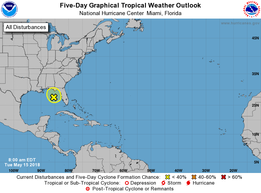
1. A broad non-tropical area of low pressure located over the
northeastern Gulf of Mexico is producing widespread cloudiness,
showers, and thunderstorms across much of Florida, southeastern
Georgia and a good portion of the Bahamas. This system has not
become any better organized since yesterday and conditions are
becoming even less favorable for subtropical or tropical cyclone
formation. This system, however, will continue to produce locally
heavy rainfall and possible flash flooding across portions of
Florida and the southeastern United States during the next few days
while the low moves generally northward. For more information on
this system, please see products issued by your local weather
office. The next Special Tropical Weather Outlook on this system
will be issued by 9 AM EDT on Wednesday.
* Formation chance through 48 hours...low...10 percent.
* Formation chance through 5 days...low...10 percent.
Forecaster Avila