ZCZC MIATWOAT ALL
TTAA00 KNHC DDHHMM
Special Tropical Weather Outlook
NWS National Hurricane Center Miami FL
345 PM EDT Mon May 14 2018
For the North Atlantic...Caribbean Sea and the Gulf of Mexico:
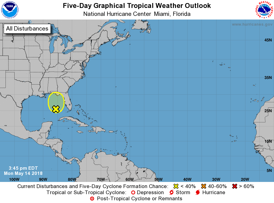
1. A deep-layer non-tropical area of low pressure located over the
eastern Gulf of Mexico continues to produce widespread cloudiness,
showers, and thunderstorms across much of Florida and southeastern
Georgia. Although this system could still acquire some subtropical
or tropical characteristics while it moves slowly northward across
the eastern Gulf of Mexico during the next few days, the low has
not shown signs of increased organization during the past 24 hours.
Regardless of subtropical or tropical cyclone formation, this system
will produce locally heavy rainfall and possible flash flooding
across portions of Florida and the southeastern United States during
the next few days. For more information on this system, please see
products issued by your local weather office. The next Special
Tropical Weather Outlook on this system will be issued by 9 AM EDT
on Tuesday.
* Formation chance through 48 hours...low...20 percent.
* Formation chance through 5 days...low...30 percent.
Forecaster Berg