ZCZC MIATWOEP ALL
TTAA00 KNHC DDHHMM
Tropical Weather Outlook
NWS National Hurricane Center Miami FL
1100 AM PDT Sat Sep 23 2017
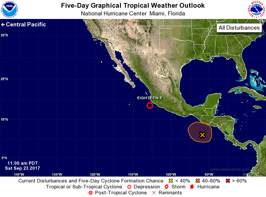
For the eastern North Pacific...east of 140 degrees west longitude:
1. Satellite-derived surface wind data indicate that the low pressure
system located about 80 miles south-southwest of Manzanillo, Mexico,
has become much better defined this morning. Shower and thunderstorm
activity has also increased and become much better organized. As a
result, advisories will be initiated on a tropical depression or
tropical storm later this afternoon. Very heavy rains are expected
over portions of southwestern Mexico during the next several days
due to the slow movement of the system.
* Formation chance through 48 hours...high...near 100 percent.
* Formation chance through 5 days...high...near 100 percent.
2. A large area of disorganized showers and thunderstorms is
associated with a broad area of low pressure located south of
Guatemala over the far eastern Pacific. Some gradual development of
this system is possible over the next few days before the system
moves inland over Central America early next week.
* Formation chance through 48 hours...low...10 percent.
* Formation chance through 5 days...medium...40 percent.
Forecaster Stewart