ZCZC MIATWOEP ALL
TTAA00 KNHC DDHHMM
Tropical Weather Outlook
NWS National Hurricane Center Miami FL
500 AM PDT Sat Sep 23 2017
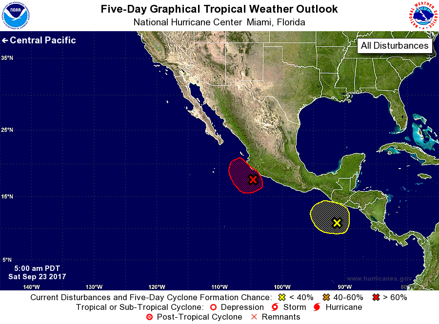
For the eastern North Pacific...east of 140 degrees west longitude:
1. A low pressure system located about 100 miles southwest of
Manzanillo, Mexico, has become better defined overnight. Although
associated shower and thunderstorm activity has changed little,
environmental conditions are expected to remain favorable for
a tropical depression to form later today or on Sunday. Interests
in Colima and Jalisco should monitor the progress of this system for
any potential watches or warnings issued this weekend. Regardless
of development, very heavy rains are expected over portions of
southwestern Mexico during the next several days.
* Formation chance through 48 hours...high...90 percent.
* Formation chance through 5 days...high...90 percent.
2. A large area of disorganized showers and thunderstorms is
associated with a broad area of low pressure located south of
Guatemala over the far eastern Pacific. Some gradual development of
this system is possible over the next few days before the system
moves over Central America early next week.
* Formation chance through 48 hours...low...10 percent.
* Formation chance through 5 days...low...30 percent.
Forecaster Stewart