ZCZC MIATWOAT ALL
TTAA00 KNHC DDHHMM
Tropical Weather Outlook
NWS National Hurricane Center Miami FL
800 PM EDT Sun Jul 30 2017
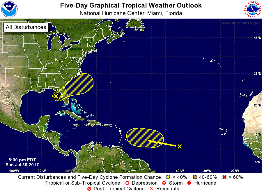
For the North Atlantic...Caribbean Sea and the Gulf of Mexico:
1. A small non-tropical low pressure area located about 140 miles west
of Tampa, Florida, is producing a limited area of thunderstorm
activity as it drifts southeastward. This system has some chance
to acquire tropical or subtropical characteristics on Monday before
it moves inland over the central Florida peninsula on Tuesday, and
into the western Atlantic by Wednesday. Regardless of development,
the low is expected to enhance locally heavy rainfall across
portions of central and northeastern Florida during the next couple
of days. Please see additional information from your local National
Weather Service Forecast Offices concerning the rainfall threat.
* Formation chance through 48 hours...low...20 percent.
* Formation chance through 5 days...low...30 percent.
2. A tropical wave located roughly midway between west Africa and the
Lesser Antilles continues to produce a large area of cloudiness
and disorganized shower activity. Any development of this system
is expected to be slow to occur over the next several days while the
system moves westward to west-northwestward at 10 to 15 mph.
* Formation chance through 48 hours...low...near 0 percent.
* Formation chance through 5 days...low...20 percent.
Forecaster Blake