ZCZC MIATWOAT ALL
TTAA00 KNHC DDHHMM
TROPICAL WEATHER OUTLOOK
NWS NATIONAL HURRICANE CENTER MIAMI FL
800 PM EDT FRI OCT 21 2016
For the North Atlantic...Caribbean Sea and the Gulf of Mexico:
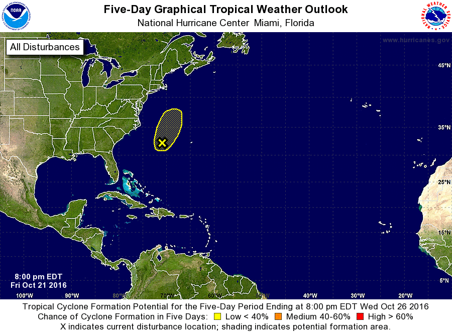
1. A non-tropical area of low pressure located about 350 miles
southeast of Cape Hatteras, North Carolina, is producing limited
shower and thunderstorm activity and winds to near gale force while
it moves north-northeastward at 15 to 20 mph. Increasing upper-
level winds are expected to limit the opportunity for this system to
become a subtropical or tropical cyclone, and this low is expected
to degenerate into a trough ahead of an approaching frontal system
tonight or early Saturday. For additional information on this
system, see High Seas Forecasts issued by the National Weather
Service.
* Formation chance through 48 hours...low...20 percent
* Formation chance through 5 days...low...20 percent
High Seas Forecasts issued by the National Weather Service can be
found under AWIPS header NFDHSFAT1, WMO header FZNT01 KWBC, and
on the Web at http://www.opc.ncep.noaa.gov/shtml/NFDHSFAT1.shtml.
Forecaster Brennan