ZCZC MIATWOEP ALL
TTAA00 KNHC DDHHMM
TROPICAL WEATHER OUTLOOK
NWS NATIONAL HURRICANE CENTER MIAMI FL
1100 AM PDT THU OCT 20 2016
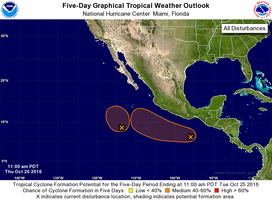
For the eastern North Pacific...east of 140 degrees west longitude:
1. A small, well-defined low pressure area centered about 700 miles
south-southwest of the southern tip of the Baja California
peninsula continues to produce some shower and thunderstorm
activity. Although upper-level winds are not particularly conducive
for further development, only a small increase in the organization
of the thunderstorm activity could result in the formation of a
tropical cyclone before upper-level winds become too strong for
formation. The low is expected to drift northward or northwestward
over the next several days.
* Formation chance through 48 hours...medium...50 percent
* Formation chance through 5 days...medium...50 percent
2. Disorganized cloudiness and showers located a few hundred miles
south of the Gulf of Tehuantepec are associated with a surface
trough. Environmental conditions are forecast to become more
favorable for some development of this disturbance over the weekend
and early next week while the system moves toward the west-northwest
at about 10 to 15 mph.
* Formation chance through 48 hours...low...20 percent
* Formation chance through 5 days...medium...50 percent
Forecaster Blake