ZCZC MIATWOEP ALL
TTAA00 KNHC DDHHMM
TROPICAL WEATHER OUTLOOK
NWS NATIONAL HURRICANE CENTER MIAMI FL
500 AM PDT WED OCT 12 2016
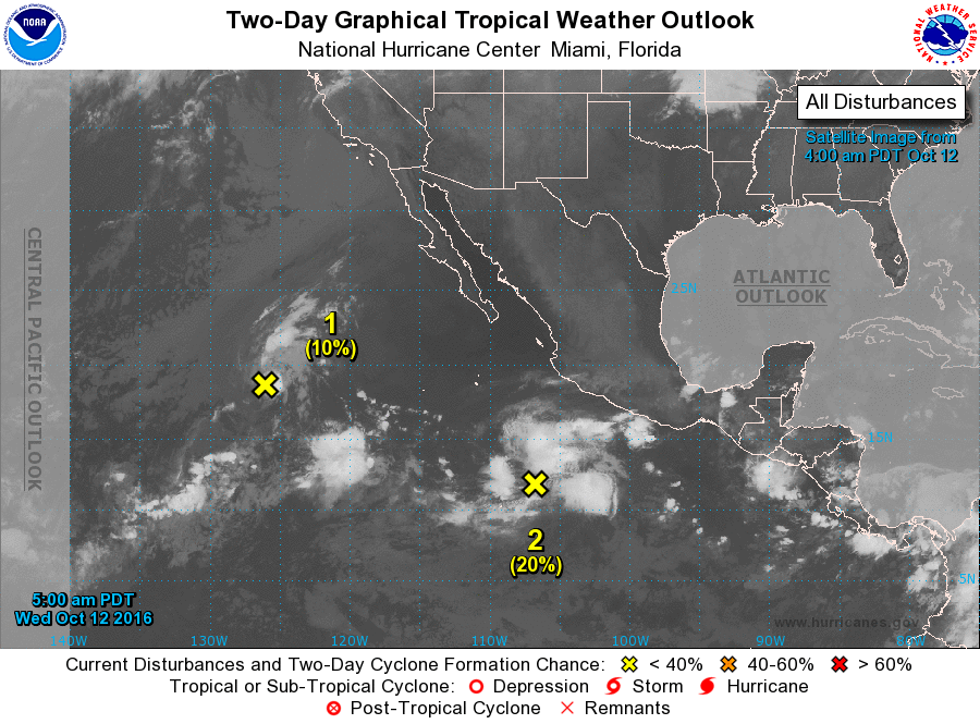
For the eastern North Pacific...east of 140 degrees west longitude:
1. An area of low pressure located about a thousand miles west-
southwest of the southern tip of the Baja California peninsula is
producing a few showers and thunderstorms. The low is about to
reach cooler waters, and tropical cyclone formation is not expected
while the system moves westward at 10 to 15 mph.
* Formation chance through 48 hours...low...10 percent
* Formation chance through 5 days...low...10 percent
2. Disorganized showers and thunderstorms located several hundred
miles south-southwest of the southern coast of Mexico are
associated with a broad area of low pressure. Some slow
development of this system is possible during the next several days
while the low moves west-northwestward at 15 to 20 mph away from
the coast of Mexico.
* Formation chance through 48 hours...low...20 percent
* Formation chance through 5 days...medium...40 percent
Forecaster Berg