ZCZC MIATWOAT ALL
TTAA00 KNHC DDHHMM
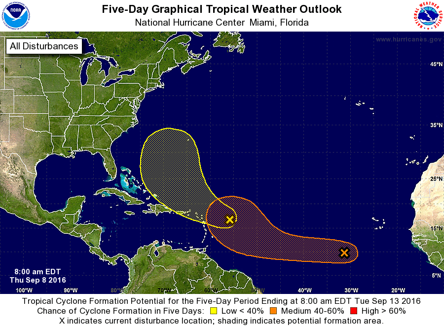
TROPICAL WEATHER OUTLOOK
NWS NATIONAL HURRICANE CENTER MIAMI FL
800 AM EDT THU SEP 8 2016
For the North Atlantic...Caribbean Sea and the Gulf of Mexico:
1. A large but disorganized area of disturbed weather located about
500 miles southwest of the Cabo Verde Islands is associated with a
tropical wave. Development of this system, if any, will likely be
slow to occur during the next couple of days. However, conditions
could become a little more favorable for gradual development, and a
tropical depression could form early next week while this system
moves westward and then west-northwestward into the central
Atlantic.
* Formation chance through 48 hours...low...10 percent
* Formation chance through 5 days...medium...60 percent
2. A concentrated area of showers and thunderstorms associated with a
broad area of low pressure has developed about 350 miles east of
the Leeward Islands. This activity is expected to move toward the
west-northwest, and additional development, if any, will be slow
to occur during the next several days.
* Formation chance through 48 hours...low...10 percent
* Formation chance through 5 days...low...20 percent
Forecaster Avila